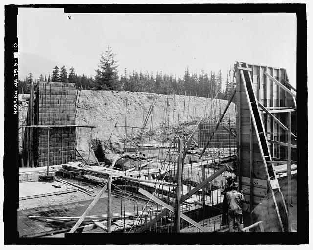
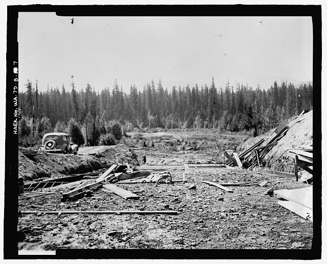
Photographic copy of photograph, G.G. Rollstin, photographer, 7 August 1936 (original print located at U.S. Bureau of Reclamation Upper Columbia Area Office, Yakima, Washington). "KACHESS DAM SPILLWAY. PLACING FORMS AND STEEL AT GATE SECTION" - Kachess Dam, 1936 Spillway and Radial Gates, Kachess River, 1.5 miles north of Interstate 90, Easton, Kittitas County, WA
4 x 5 in.
- Place
- Snoqualmie Pass, Kittitas
- Credit
- Library of Congress (HABS/HAER)
- Rights
- Public domain — free to reuseReport a rights issue
- Source
- Where this copy came from ↗
Stories from Kittitas
All 10 stories from Kittitas →More from Kittitas
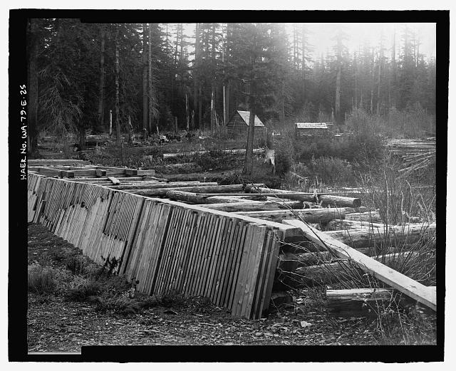 Photographic copy of photograph, photographer unknown, 1 November 1905 (original print located at U.S. Bureau of Reclamation Upper Columbia Area Office, Yakima, Washington). "VIEW SHOWING LOCATION OF PROPOSED DAM SITE AT OUTLET OF LAKE KACHESS, WASHINGTON" - Kachess Dam, 1904 Cascade Canal Company Crib Dam, Kachess River, 1.5 miles north of Interstate 90, Easton, Kittitas County, WA
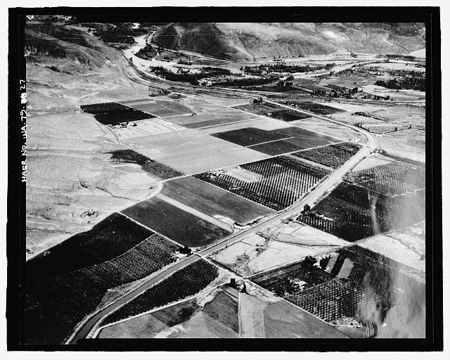 27. Photographic copy of photograph, Joseph Yolo, photographer, 1936 (original print located at U.S. Bureau of Reclamation Upper Columbia Area Office, Yakima, Washington). "WAHT A GOVERNMENT CANAL AND AN ASSURED WATER SUPPLY WILL DO IN A DESERT AREA IS SHOWN IN THIS AIR VIEW OF A SECTION OF THE YAKIMA FEDERAL RECLAMATION PROJECT IN CENTRAL WASHINGTON. THE MAIN CANAL IS SEEN RUNNING DOWN THE MIDDLE OF THE VALLEY WITH PATCHES OF ORCHARDS AND FIELDS ON EITHER SIDE, BUT ABOVE THE CANAL LINE THE SAGE BRUSH DESERT REMAINS, AS CAN BE SEEN ON THE LEFT. THE YAKIMA PROJECT SUPPORTS MORE THAN 110,000 PEOPLE IN A TERRITORY WHICH WAS DESERT 35 YEARS AGO. MANY OF THE ORIGINAL SETTLERS WHO CAME, LIKE THOSE WHO ARE NOW SETTLING ON THE VALE PROJECT, TO BREAK THE RAW DESERT LAND, ARE STILL LIVING ON THESE NEATLY CHECKERBOARDED FARMS" - Kachess Dam, Kachess River, 1.5 miles north of Interstate 90, Easton, Kittitas County, WA
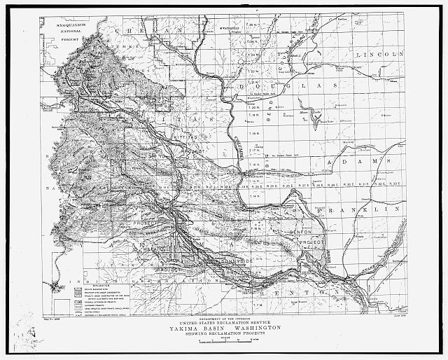 28. Photocopy of construction drawing, U.S. Reclamation Service, June 1909 (original print located at U.S. Bureau of Reclamation Upper Columbia Area Office, Yakima, Washington). "YAKIMA BASIN WASHINGTON, SHOWING RECLAMATION PROJECTS" - Kachess Dam, Kachess River, 1.5 miles north of Interstate 90, Easton, Kittitas County, WA
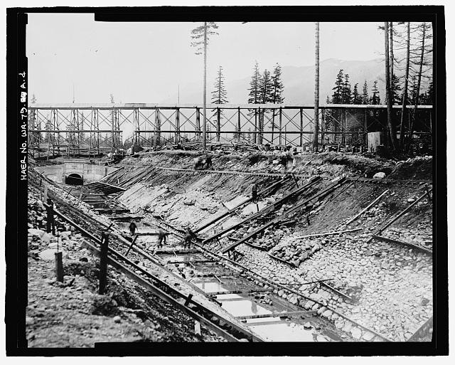 Photographic copy of photograph, photographer unknown, 1912 (original print located at U.S. Bureau of Reclamation Upper Columbia Area Office, Yakima, Washington). "LINING OF OUTLET TUNNEL [BELOW THE DAM]" - Kachess Dam, Outlet Channel, Kachess River, 1.5 miles north of Interstate 90, Easton, Kittitas County, WA
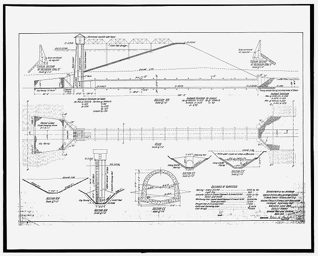 Photocopy of construction drawing, U.S. Reclamation Service, April 1910 (original print located at U.S. Bureau of Reclamation Upper Columbia Area Office, Yakima, Washington). "KACHESS LAKE DAM - OUTLET WORKS" - Kachess Dam, Outlet Channel, Kachess River, 1.5 miles north of Interstate 90, Easton, Kittitas County, WA
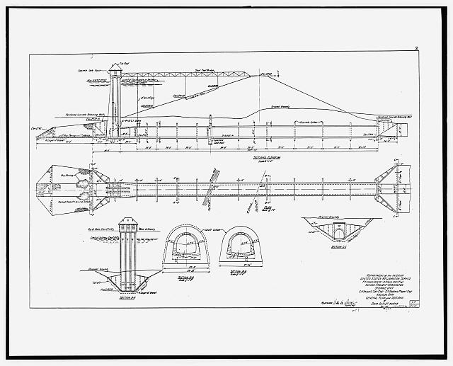 Photocopy of construction drawing, U.S. Reclamation Service, April 1912 (original print located at U.S. Bureau of Reclamation Upper Columbia Area Office, Yakima, Washington). "GENERAL PLAN AND SECTIONS" - Kachess Dam, Outlet Channel, Kachess River, 1.5 miles north of Interstate 90, Easton, Kittitas County, WA
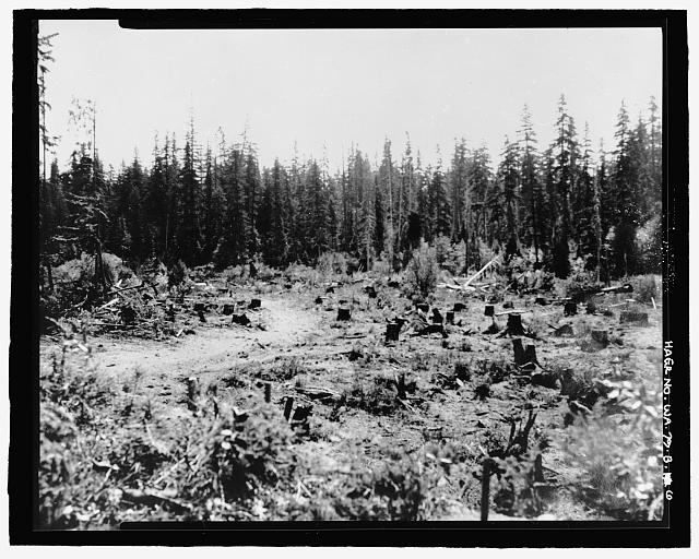 Photographic copy of photograph, G.G. Rollstin, photographer, 29 July 1936 (original print located at U.S. Bureau of Reclamation Upper Columbia Area Office, Yakima, Washington). "CLEARING OPERATION AT LOWER END OF OUTLET CHANNEL" - Kachess Dam, 1936 Spillway and Radial Gates, Kachess River, 1.5 miles north of Interstate 90, Easton, Kittitas County, WA
 Photographic copy of photograph, G.G. Rollstin, photographer, 3 August 1936 (original print located at U.S. Bureau of Reclamation Upper Columbia Area Office, Yakima, Washington). "LOOKING DOWNSTREAM FROM STATION 10+43" - Kachess Dam, 1936 Spillway and Radial Gates, Kachess River, 1.5 miles north of Interstate 90, Easton, Kittitas County, WA