Photographs
879 photographs of the places in the archive's stories: streets, harbours, mills and the people in them. Search them, or narrow by decade and town.
154 photographs · Show them all
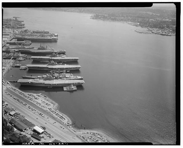 1. AERIAL VIEW, NAVAL INACTIVE SHIPS MAINTENANCE FACILITY, SINCLAIR ISLET, BREMERTON, KITSAP COUNTY, WASHINGTON WITH EX-USS HORNET CVS-12, THREE MINECRAFT ALONGSIDE TO PORT. OTHER INACTIVE SHIPS IN BACKGROUND. - U.S.S. HORNET, Puget Sound Naval Shipyard, Sinclair Inlet, Bremerton, Kitsap County, WA
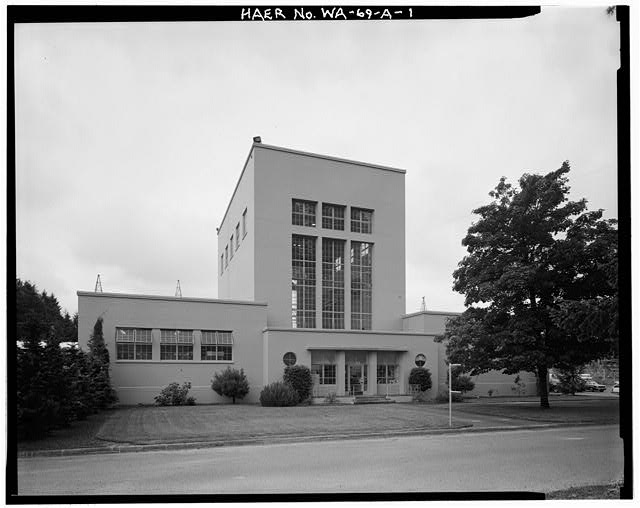 1. VIEW OF UNTANKING TOWER FACADE, LOOKING SOUTH - Bonneville Power Administration Chehalis Substation, Untanking Tower, State Route 603, West of Interstate 5, Napavine, Lewis County, WA
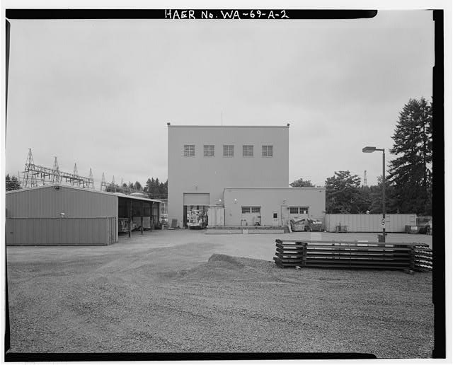 2. VIEW OF UNTANKING TOWER SECONDARY FACADE, LOOKING WEST, WITH SWITCHING YARD IN LEFT BACKGROUND - Bonneville Power Administration Chehalis Substation, Untanking Tower, State Route 603, West of Interstate 5, Napavine, Lewis County, WA
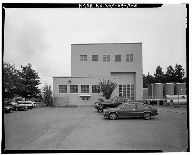 3. VIEW OF UNTANKING TOWER SECONDARY FACADE, LOOKING EAST WITH OIL STORAGE TANKS IN RIGHT BACKGROUND - Bonneville Power Administration Chehalis Substation, Untanking Tower, State Route 603, West of Interstate 5, Napavine, Lewis County, WA
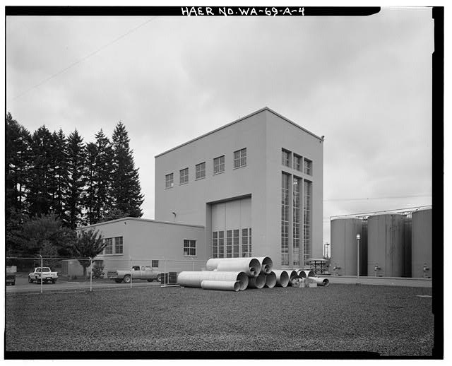 4. VIEW OF UNTANKING TOWER, SECONDARY (WEST) FACADE AND REAR FACADE, LOOKING NORTHEAST - Bonneville Power Administration Chehalis Substation, Untanking Tower, State Route 603, West of Interstate 5, Napavine, Lewis County, WA
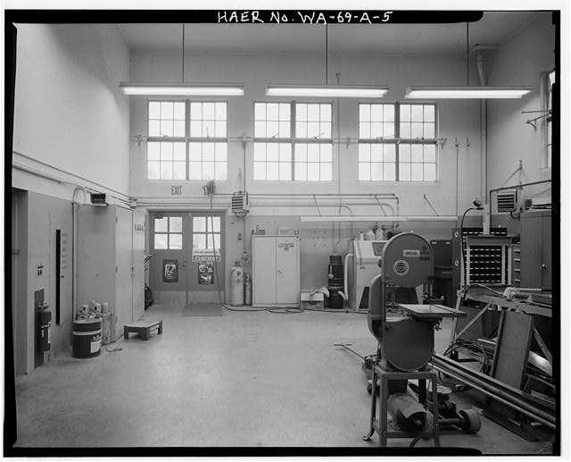 5. INTERIOR VIEW OF ELECTRICIAN'S WORKSHOP (NORTHWEST FACADE), SHOWING UNTANKING TOWER, LOOKING WEST AT ORIGINAL DOORWAY AND ABOVE PAIRED WINDOW TO BE REPLACED WITH A METAL ROLL-UP UTILITY DOOR - Bonneville Power Administration Chehalis Substation, Untanking Tower, State Route 603, West of Interstate 5, Napavine, Lewis County, WA
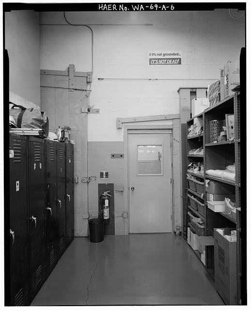 6. INTERIOR VIEW OF ELECTRICIAN'S SUPPLY ROOM (SOUTHWEST FACADE), SHOWING UNTANKING TOWER, LOOKING WEST - Bonneville Power Administration Chehalis Substation, Untanking Tower, State Route 603, West of Interstate 5, Napavine, Lewis County, WA
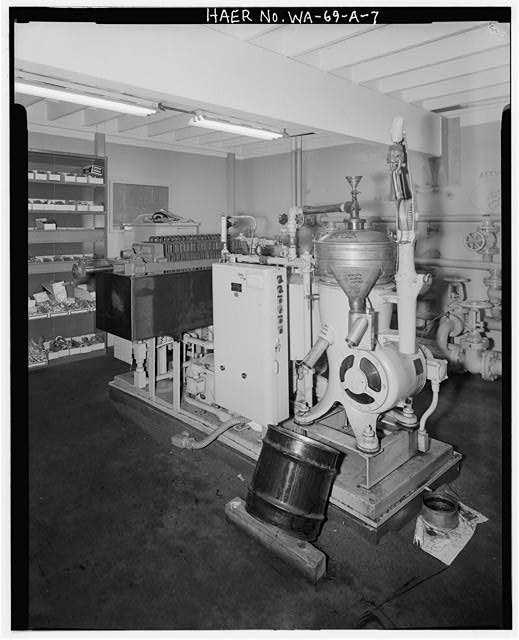 7. VIEW OF OIL PRESS, OIL PRESS ROOM, BASEMENT - Bonneville Power Administration Chehalis Substation, Untanking Tower, State Route 603, West of Interstate 5, Napavine, Lewis County, WA
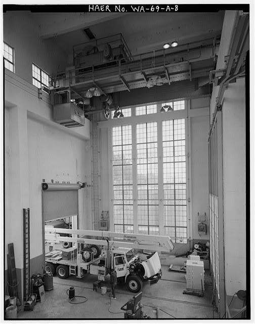 8. INTERIOR VIEW OF ASSEMBLY ROOM (REAR FACADE), UNTANKING TOWER, SHOWING PREVIOUS MODIFICATIONS (INSTALLATION OF METAL ROLL-UP DOOR, LEFT FOREGROUND). 125-TON LIFTING CRANE (TOP FOREGROUND), AND ORIGINAL FLOOR-TO-CEILING MULTI-PANE, METAL-CASED WINDOWS - Bonneville Power Administration Chehalis Substation, Untanking Tower, State Route 603, West of Interstate 5, Napavine, Lewis County, WA
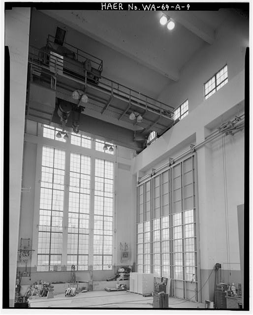 9. INTERIOR VIEW OF ASSEMBLY ROOM (REAR FACADE), UNTANKING TOWER, LOOKING SOUTHWEST, SHOWING TRI-SECTION SLIDING ENTRANCE DOORWAY (RIGHT FOREGROUND), AND RAIL TRACKS IN FLOORING ENTERING THE STRUCTURE FROM THE SWITCHING YARD - Bonneville Power Administration Chehalis Substation, Untanking Tower, State Route 603, West of Interstate 5, Napavine, Lewis County, WA
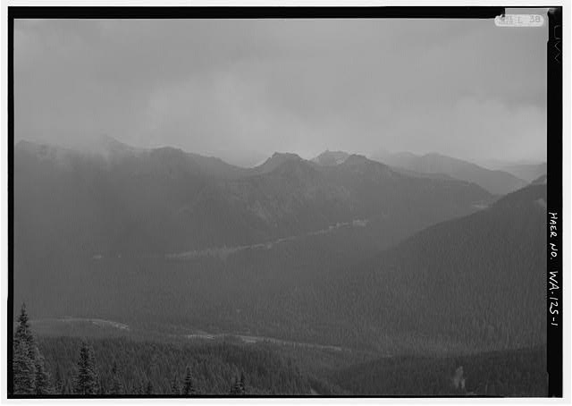 1. VIEW FROM SUNRISE POINT FACING SOUTHEAST - Mather Memorial Parkway, Between Northeast Entrance & Chinook Pass, Longmire, Pierce County, WA
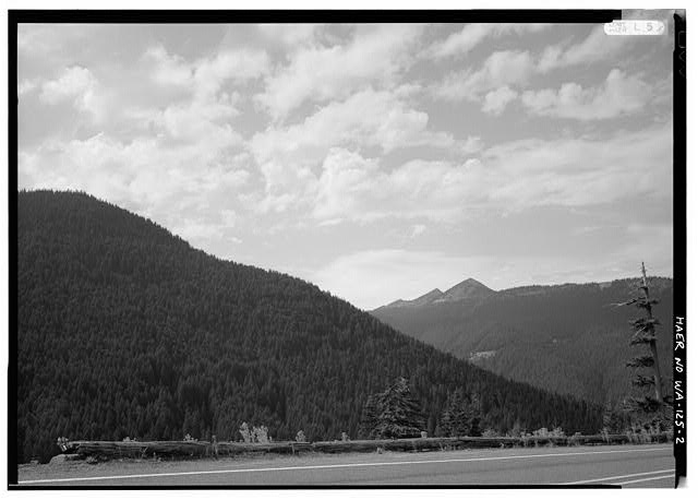 2. RUSTIC WOODEN GUARDRAIL NEAR WHITE RIVER OVERLOOK FACING WEST - Mather Memorial Parkway, Between Northeast Entrance & Chinook Pass, Longmire, Pierce County, WA
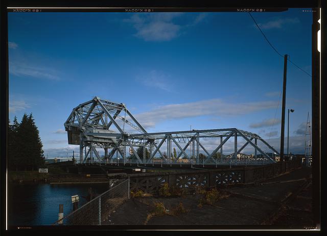 Wishkah River Bridge in Aberdeen, Washington
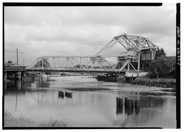 Wishkah River Bridge Closed Span in Aberdeen
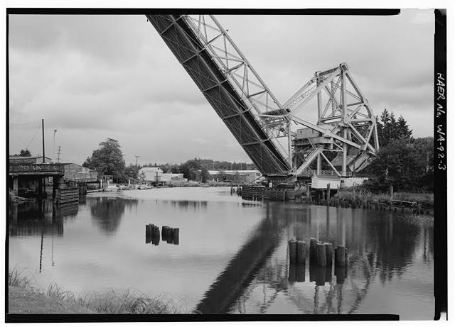
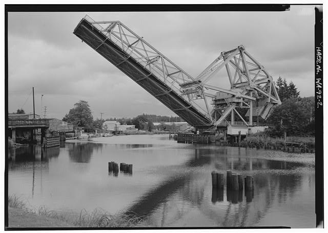 Partially Open Wishkah River Bridge in Aberdeen
 Crowd gathered for Wishkah River Bridge opening in Aberdeen
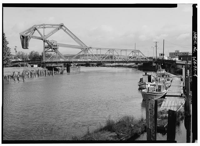 Closed Wishkah River Bridge, Aberdeen, Washington
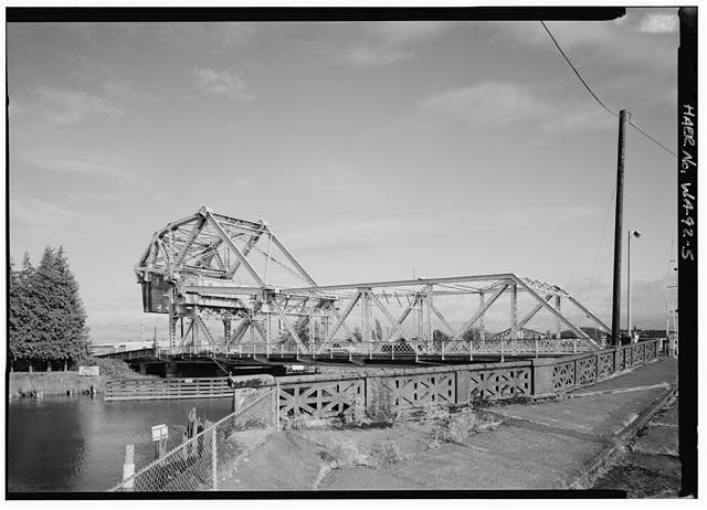 Perspective view southeast of Wishkah River Bridge, Aberdeen
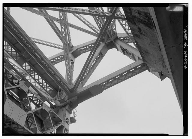 Counterweight superstructure detail of Wishkah River Bridge
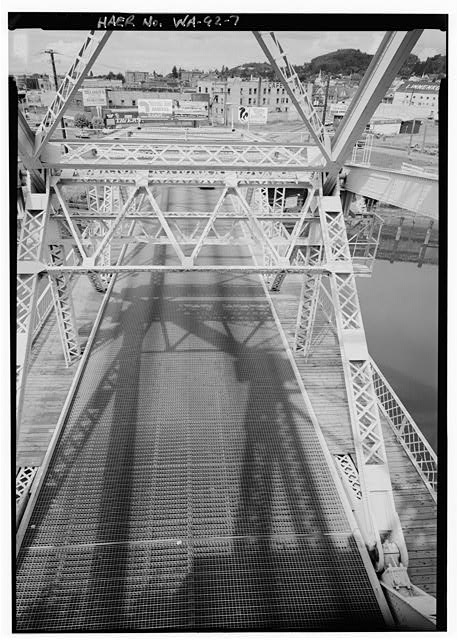 Roadway View from Wishkah River Bridge Control House Deck
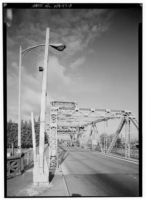 Western portal of Wishkah River Bridge lift span looking east
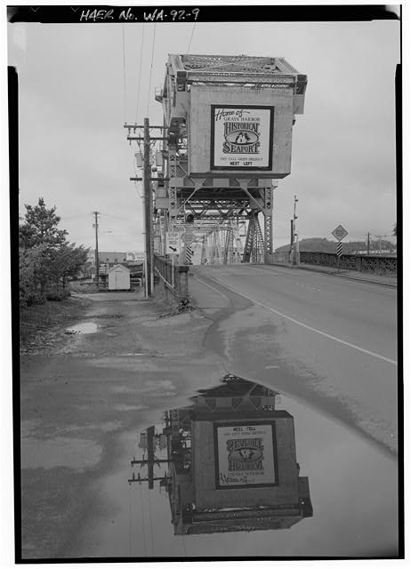 Wishkah River Bridge on Wishkah Street in Aberdeen
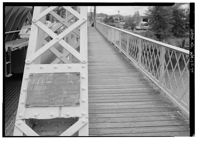 1924 Wishkah River Bridge Nameplate Detail, Aberdeen
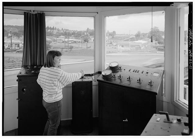 Bridge tender at Wishkah River Bridge in Aberdeen
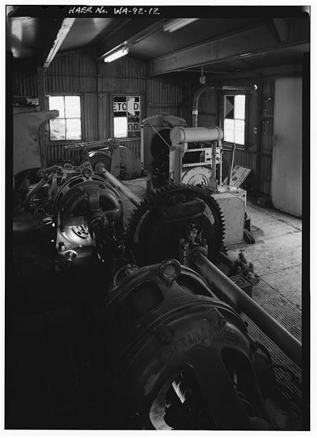 Machinery Room with Drive Engines and Emergency Generator
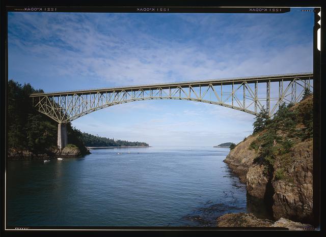 8. DECEPTION PASS BRIDGE LOOKING WEST FROM WATER LEVEL - Deception Pass Bridge, Spanning Deception Pass at State Route 20, Anacortes, Skagit County, WA
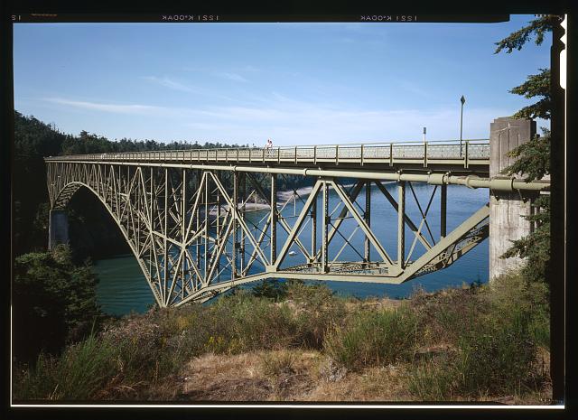 9. OBLIQUE PERSPECTIVE LOOKING SW OF EASTERN SIDE OF BRIDGE - Deception Pass Bridge, Spanning Deception Pass at State Route 20, Anacortes, Skagit County, WA
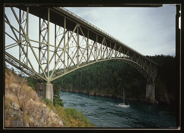 10. WEST SIDE OF BRIDGE LOOKING SE - Deception Pass Bridge, Spanning Deception Pass at State Route 20, Anacortes, Skagit County, WA
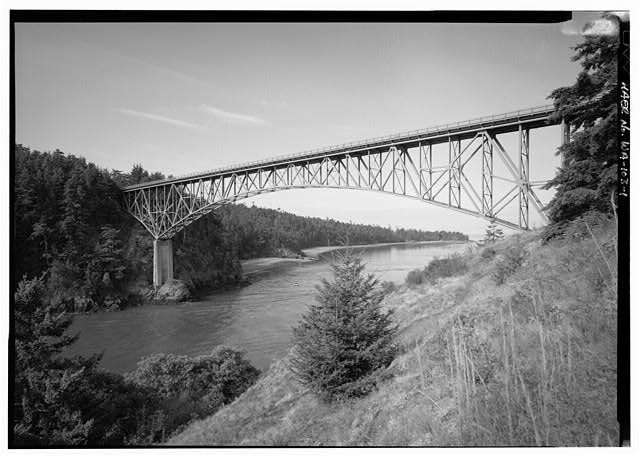 1. DECEPTION PASS BRIDGE LOOKING WEST - Deception Pass Bridge, Spanning Deception Pass at State Route 20, Anacortes, Skagit County, WA
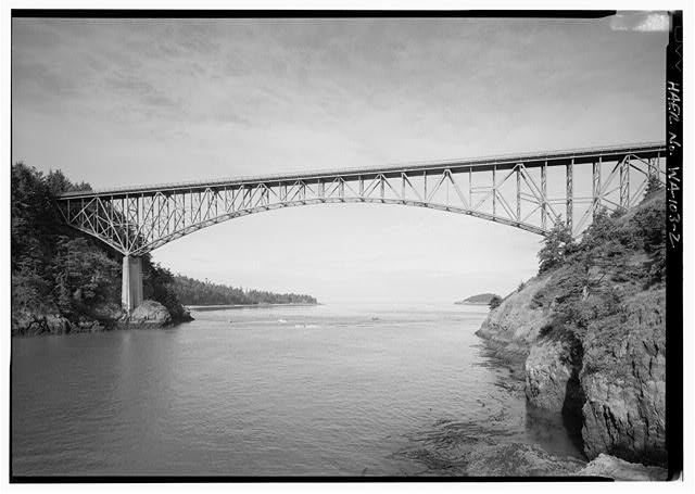 2. DECEPTION PASS BRIDGE LOOKING WEST FROM WATER LEVEL - Deception Pass Bridge, Spanning Deception Pass at State Route 20, Anacortes, Skagit County, WA
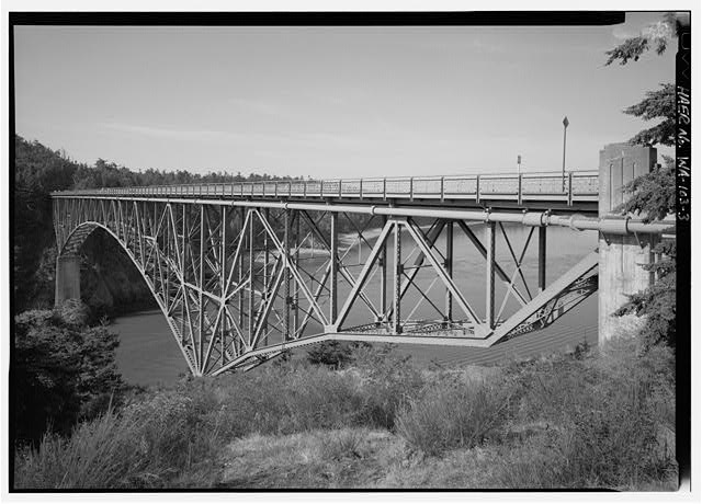 3. OBLIQUE PERSPECTIVE LOOKING SW OF EASTERN SIDE OF BRIDGE - Deception Pass Bridge, Spanning Deception Pass at State Route 20, Anacortes, Skagit County, WA
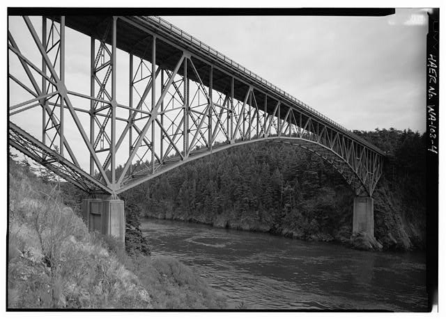 4. WEST SIDE OF BRIDGE LOOKING SE - Deception Pass Bridge, Spanning Deception Pass at State Route 20, Anacortes, Skagit County, WA
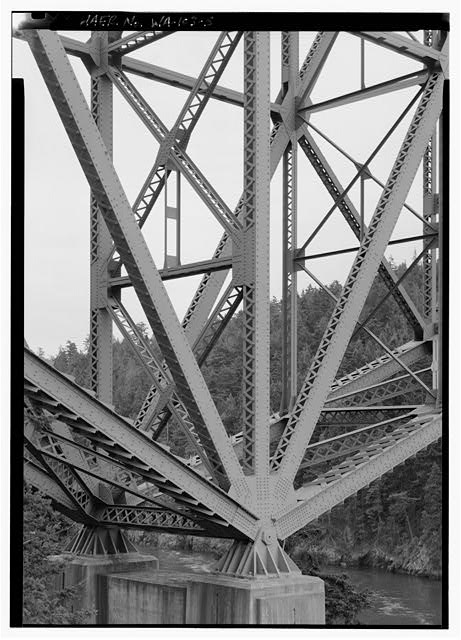 5. DETAIL OF NORTH TOWER BASE OF CANTILEVER - Deception Pass Bridge, Spanning Deception Pass at State Route 20, Anacortes, Skagit County, WA
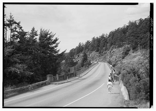 6. DECEPTION PASS BRIDGE ROADWAY LOOKING NORTH - Deception Pass Bridge, Spanning Deception Pass at State Route 20, Anacortes, Skagit County, WA
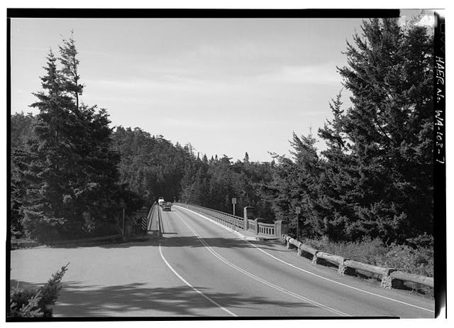 7. DECEPTION PASS BRIDGE FROM NORTH PORTAL LOOKING SOUTH - Deception Pass Bridge, Spanning Deception Pass at State Route 20, Anacortes, Skagit County, WA
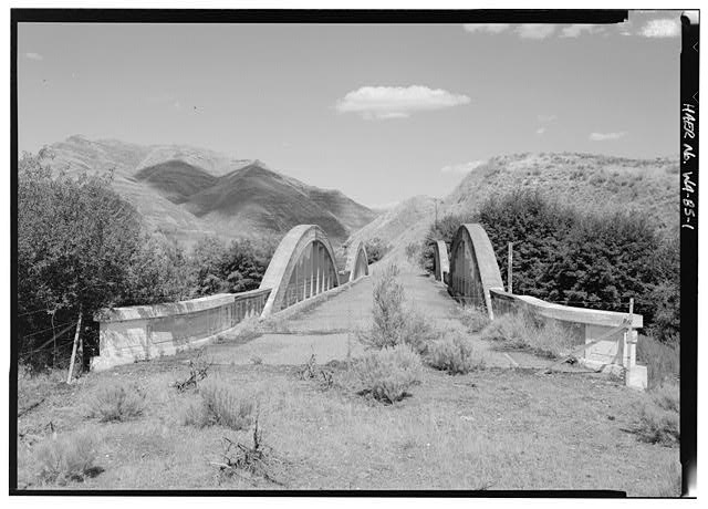 1. WESTERN PORTAL LOOKING NE BY 20 DEGREES - Indian Timothy Memorial Bridge, U.S. Route 12 spanning Alpowa Creek, Silcott, Asotin County, WA
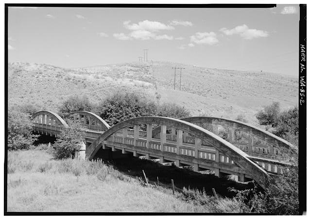 2. PERSPECTIVE OF DOUBLE ARCHES LOOKING 40 DEGREES EAST - Indian Timothy Memorial Bridge, U.S. Route 12 spanning Alpowa Creek, Silcott, Asotin County, WA
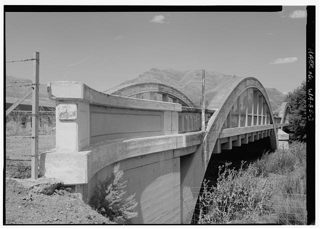 3. WESTERN ABUTMENT AND CONCRETE AND RAILING DETAIL - Indian Timothy Memorial Bridge, U.S. Route 12 spanning Alpowa Creek, Silcott, Asotin County, WA
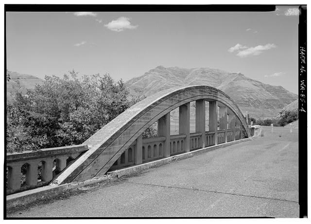 4. ROADWAY ARCH AND RAILING DETAIL, EASTERN END OF BRIDGE - Indian Timothy Memorial Bridge, U.S. Route 12 spanning Alpowa Creek, Silcott, Asotin County, WA
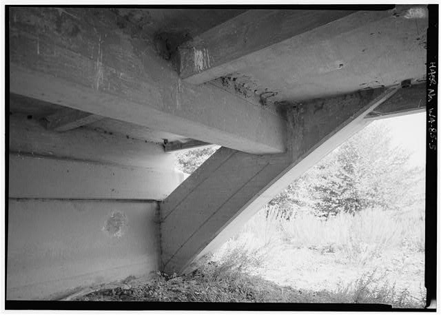 5. CONSTRUCTION DETAIL BELOW DECK - Indian Timothy Memorial Bridge, U.S. Route 12 spanning Alpowa Creek, Silcott, Asotin County, WA
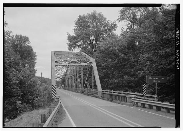 1. SOUTH PORTAL OF DOSEWALLIPS LOOKING NORTH BY 350 DEGREES - Dosewallips River Bridge, U.S. Route 101 spanning Dosewallips River, Brinnon, Jefferson County, WA
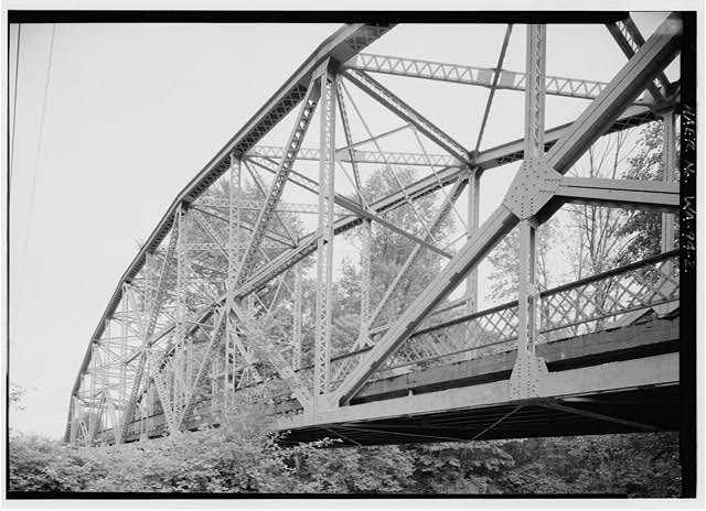 2. WESTERN PANEL OF TRUSS FROM NEAR SW ABUTMENT - Dosewallips River Bridge, U.S. Route 101 spanning Dosewallips River, Brinnon, Jefferson County, WA
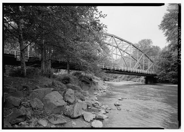 3. PERSPECTIVE OF BRIDGE LOOKING 310 DEGREES NORTH - Dosewallips River Bridge, U.S. Route 101 spanning Dosewallips River, Brinnon, Jefferson County, WA
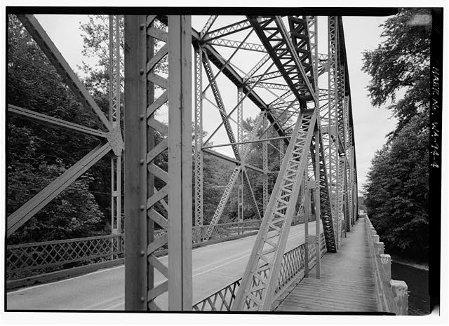 4. LACED CHANNELS AND OTHER STRUCTURAL DETAILS, MIDSPAN LOOKING NORTH BY 300 DEGREES - Dosewallips River Bridge, U.S. Route 101 spanning Dosewallips River, Brinnon, Jefferson County, WA
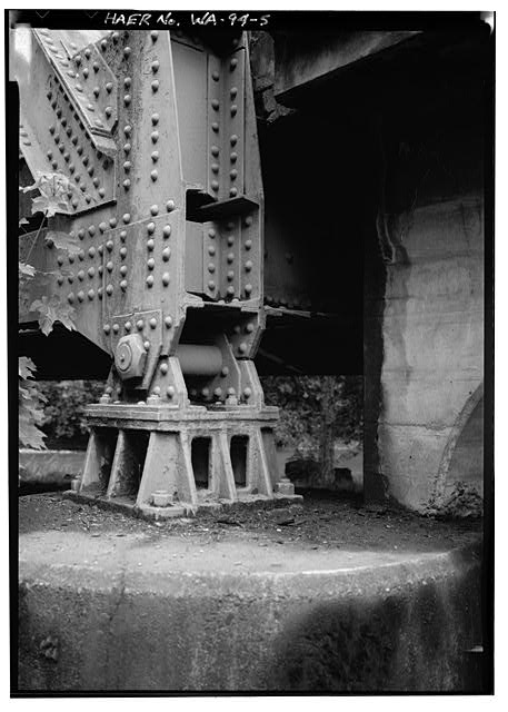 5. PIN CONNECTED FIXED END SW ABUTMENT - Dosewallips River Bridge, U.S. Route 101 spanning Dosewallips River, Brinnon, Jefferson County, WA
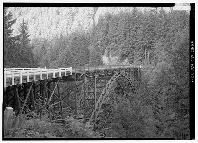 1. GENERAL VIEW LOOKING NORTH - Fairfax Bridge, Spanning Carbon River at State Route 165, Carbonado, Pierce County, WA
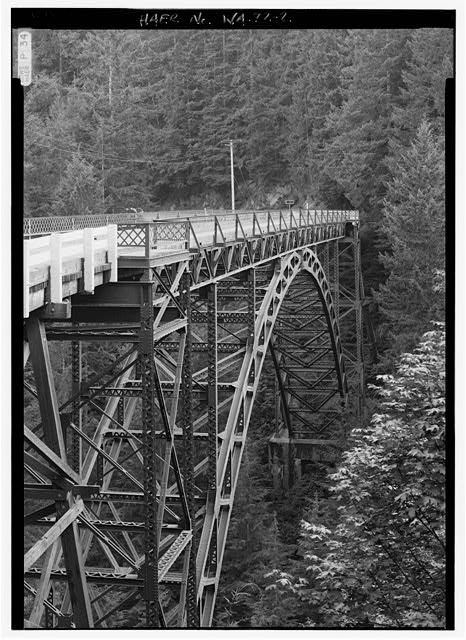 2. OBLIQUE PERSPECTIVE LOOKING SOUTH UNDER LATE AFTERNOON LIGHT - Fairfax Bridge, Spanning Carbon River at State Route 165, Carbonado, Pierce County, WA
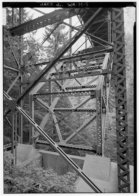 3. SOUTHERN ABUTMENT AT BOTTOM OF ARCH - Fairfax Bridge, Spanning Carbon River at State Route 165, Carbonado, Pierce County, WA
Credits and rights are shown with each photograph. Is one of them yours, or wrongly credited? Open it and use Report a rights issue.