Photographs
136 photographs of the places in the archive's stories: streets, harbours, mills and the people in them. Search them, or narrow by decade and town.
50 photographs · Show them all
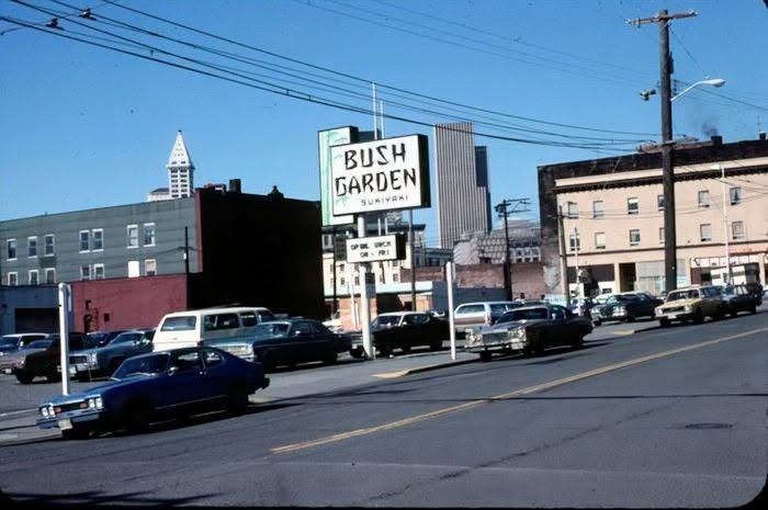
 Panoramic Historic View of Seattle Cityscape, Washington
 Historic cityscape view of Seattle, Washington
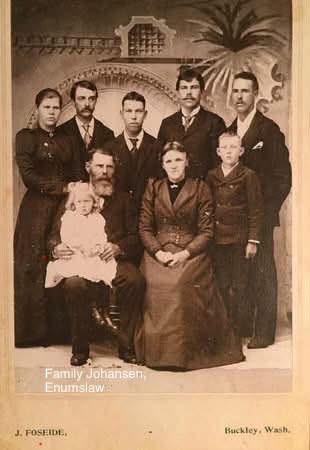
 Unidentified vintage photograph with no recorded location
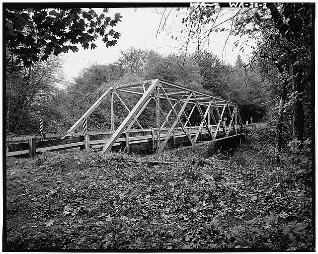 Side View of West Wishkah Bridge in Aberdeen
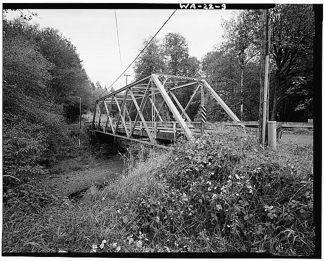 Side View of West Wishkah Bridge, Aberdeen, Washington
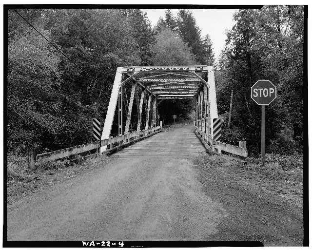 West Wishkah Bridge Front View Facing South
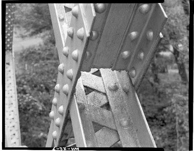 Structural Detail of West Wishkah Bridge Near Aberdeen
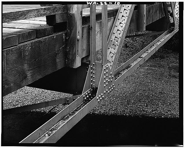 Steel chord and beam connection detail on West Wishkah Bridge
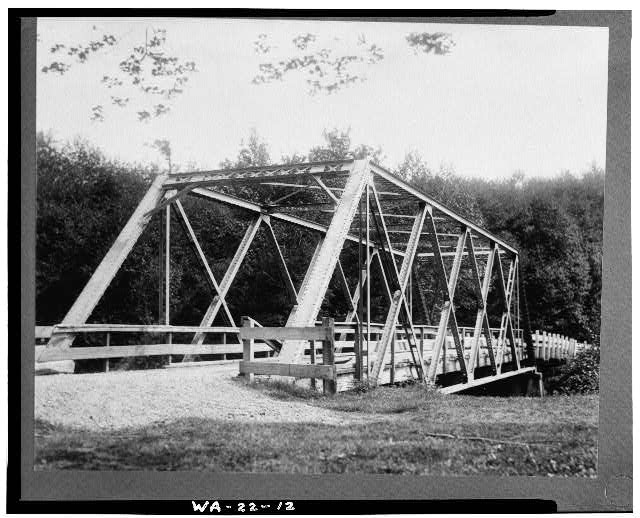 Side View of West Wishkah Bridge in Aberdeen, Before 1934
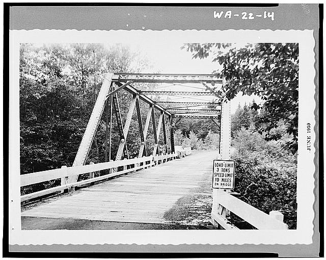 West Wishkah Bridge spanning Middle Fork Wishkah River
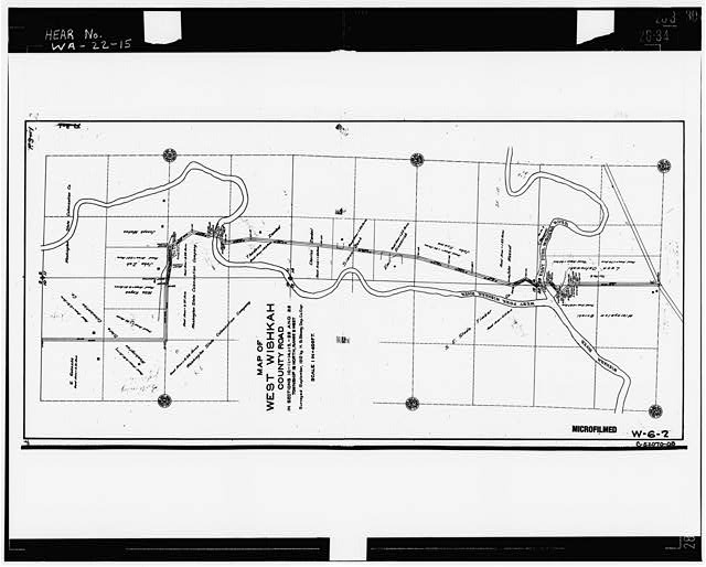 1912 Map Showing West Wishkah Road and Bridge
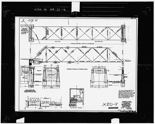 1915 Engineering Plan Drawing of West Wishkah Bridge
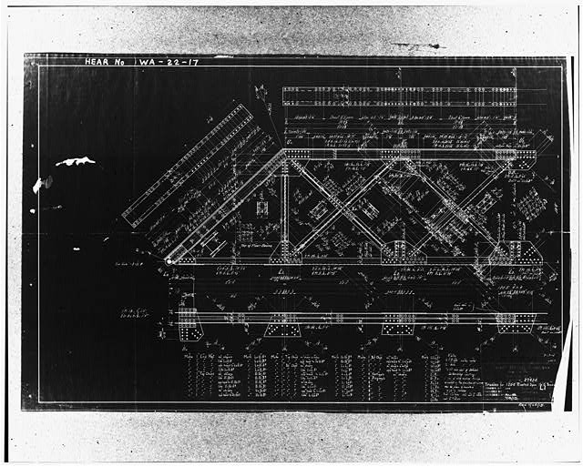 1915 Steel Truss Blueprint of West Wishkah Bridge
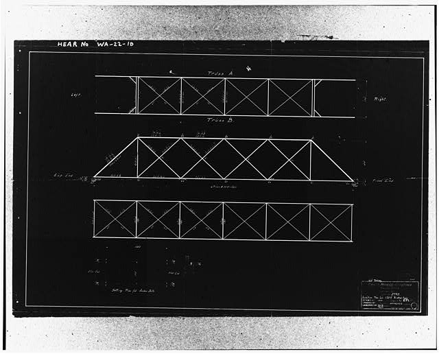 Blueprint of West Wishkah Bridge Spanning Wishkah River
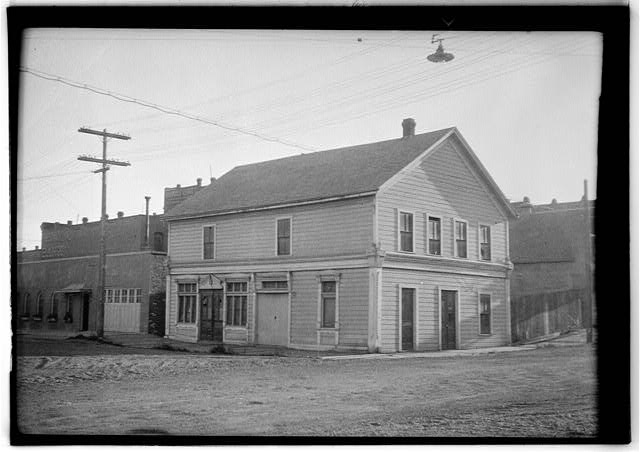 Starrett Building at Adams and Washington Streets, Port Townsend
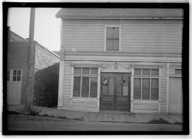 Starrett Building on Adams and Washington Streets in Port Townsend
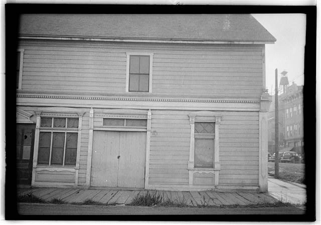 Starrett Building at Adams and Washington Streets, Port Townsend
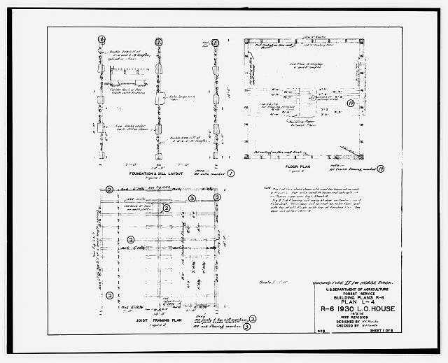 22. Photocopy of "Sheet 1 of 8" showing Foundation and Sill Layout, Floor Plan and Joist Framing Plan. From a 1932 set of building plans made for the U.S. Department of Agriculture, Forest Service and labeled "R-6 1930 L.O. House, 14' x 14', 1932 Revision, designed by K.E. Banks." In handscript, each drawing is also labeled with "Ground Type 'D' for Horse Pack." Original drawing in the collection of Entiat Ranger Station, Wenatchee National Forest, Entiat, WA. - Badger Mountain Lookout, .125 mile northwest of Badger Mountain summit, East Wenatchee, Douglas County, WA
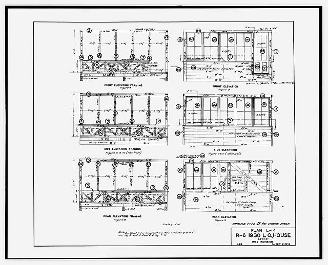 23. Photocopy of "Sheet 2 of 8" showing Front, Side and Rear Elevations and the Framing for those elevations. From a 1932 set of building plans made for the U.S. Department of Agriculture, Forest Service and labeled "R-6 1930 L.O. House, 14' x 14', 1932 Revision, designed by K.E. Banks." In handscript, each drawing is also labeled with "Ground Type 'D' for Horse Pack." Original drawing in the collection of Entiat Ranger Station, Wenatchee National Forest, Entiat, WA. - Badger Mountain Lookout, .125 mile northwest of Badger Mountain summit, East Wenatchee, Douglas County, WA
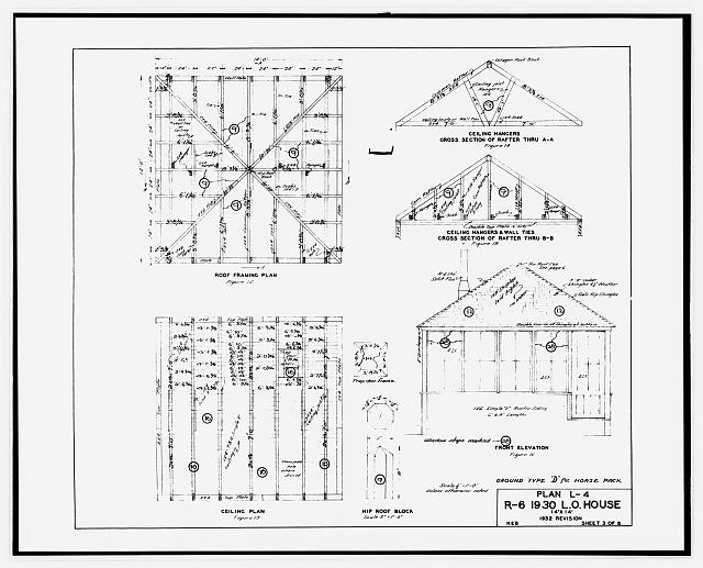 24. Photocopy of "Sheet 3 of 8" showing Roof Framing Plan, Ceiling Plan, Ceiling Hangers and Wall Ties, Cross Section of Rafters, and Front Elevation. From a 1932 set of building plans made for the U.S. Department of Agriculture, Forest Service and labeled "R-6 1930 L.O. House, 14' x 14', 1932 Revision, designed by K.E. Banks." In handscript, each drawing is also labeled with "Ground Type 'D' for Horse Pack." Original drawing in the collection of Entiat Ranger Station, Wenatchee National Forest, Entiat, WA. - Badger Mountain Lookout, .125 mile northwest of Badger Mountain summit, East Wenatchee, Douglas County, WA
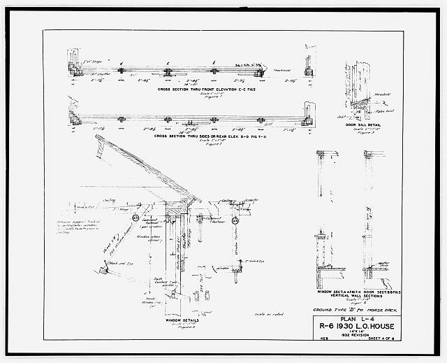 25. Photocopy of "Sheet 4 of 8" showing Window Details, Door Sill Detail, Vertical Wall Sections, and Cross Sections Thru Front, Side and Rear Elevations. From a 1932 set of building plans made for the U.S. Department of Agriculture, Forest Service and labeled "R-6 1930 L.O. House, 14' x 14', 1932 Revision, designed by K.E. Banks." In handscript, each drawing is also labeled with "Ground Type 'D' for Horse Pack." Original drawing in the collection of Entiat Ranger Station, Wenatchee National Forest, Entiat, WA. - Badger Mountain Lookout, .125 mile northwest of Badger Mountain summit, East Wenatchee, Douglas County, WA
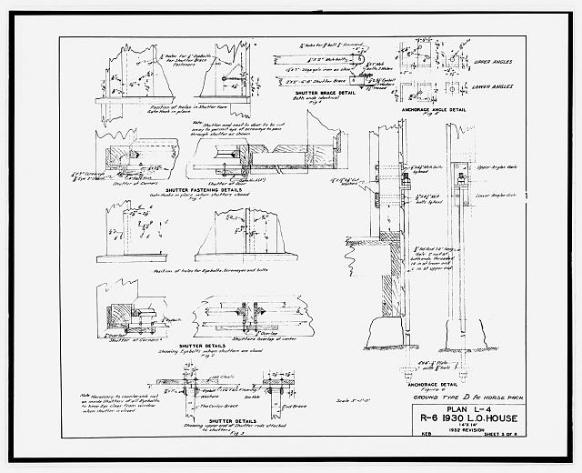 26. Photocopy of "Sheet 5 of 8" showing Shutter and Anchorage Details. From a 1932 set of building plans made for the U.S. Department of Agriculture, Forest Service and labeled "R-6 1930 L.O. House, 14' x 14', 1932 Revision, designed by K.E. Banks." In handscript, each drawing is also labeled with "Ground Type 'D' for Horse Pack." Original drawing in the collection of Entiat Ranger Station, Wenatchee National Forest, Entiat, WA. - Badger Mountain Lookout, .125 mile northwest of Badger Mountain summit, East Wenatchee, Douglas County, WA
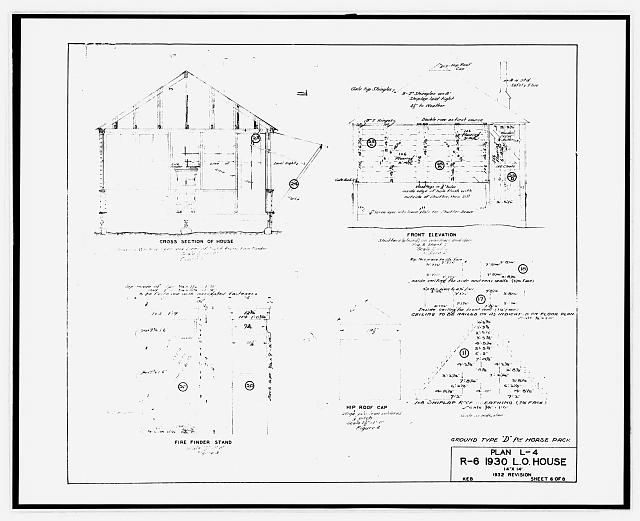 27. Photocopy of "Sheet 6 of 8" showing Cross Section of House, Front Elevation, Fire Finder Stand, Hip Roof Cap, and Shiplap Roof Sheathing. From a 1932 set of building plans made for the U.S. Department of Agriculture, Forest Service and labeled "R-6 1930 L.O. House, 14' x 14', 1932 Revision, designed by K.E. Banks." In handscript, each drawing is also labeled with "Ground Type 'D' for Horse Pack." Original drawing in the collection of Entiat Ranger Station, Wenatchee National Forest, Entiat, WA. - Badger Mountain Lookout, .125 mile northwest of Badger Mountain summit, East Wenatchee, Douglas County, WA
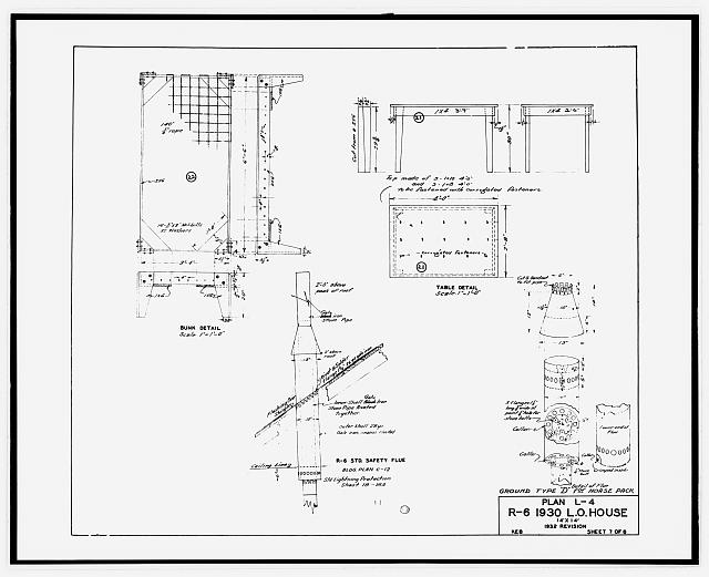 28. Photocopy of "Sheet 7 of 8" showing Bunk Detail, Table Detail and R-6 Standard Safety Flue. From a 1932 set of building plans made for the U.S. Department of Agriculture, Forest Service and labeled "R-6 1930 L.O. House, 14' x 14', 1932 Revision, designed by K.E. Banks." In handscript, each drawing is also labeled with "Ground Type 'D' for Horse Pack." Original drawing in the collection of Entiat Ranger Station, Wenatchee National Forest, Entiat, WA. - Badger Mountain Lookout, .125 mile northwest of Badger Mountain summit, East Wenatchee, Douglas County, WA
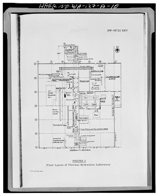 10. Floor Layout of Thermal Hydraulics Laboratory, from The Thermal Hydraulics Laboratory at Hanford. General Electric Company, Hanford Atomic Products Operation, Richland, Washington, 1961. - D-Reactor Complex, Deaeration Plant-Refrigeration Buildings, Area 100-D, Richland, Benton County, WA
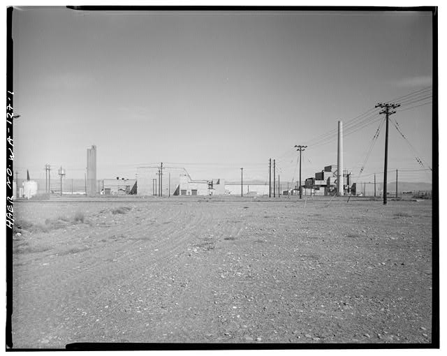 1. 190-D Complex to the left (from left to right, 195-D, 189/185-D, 190-D, 1724-DA, 190-DA Annex). D-Reactor to the right. Looking north. - D-Reactor Complex, Area 100-D, Richland, Benton County, WA
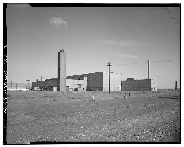 2. 190-D Complex (from left to right, 195-D, 189/185-D, 190-D). Looking northeast. - D-Reactor Complex, Area 100-D, Richland, Benton County, WA
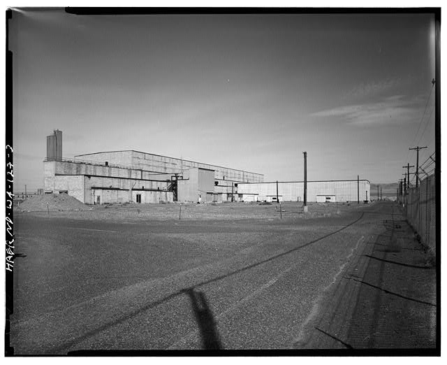 3. 190-D Complex (from left to right, 195-D, 190-D, 1724-DA, 190-DA Annex). Looking northwest. - D-Reactor Complex, Area 100-D, Richland, Benton County, WA
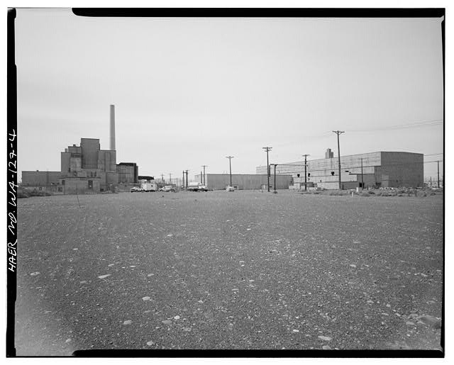 4. 190-D Complex to the right (from left to right, 190-DA, 190-D, tip of 195-D in center). D-Reactor to the left. Looking south. - D-Reactor Complex, Area 100-D, Richland, Benton County, WA
 5. 190-D Complex in center (from left to right, 190-D, 189/189-D, 195-D). D-Reactor to the left. Looking southeast. - D-Reactor Complex, Area 100-D, Richland, Benton County, WA
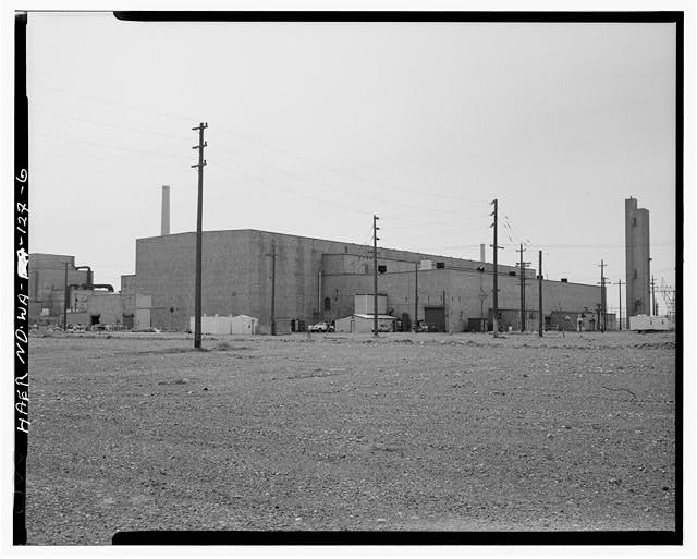 6. 190-D Complex (from left to right, 190-D, 185/189-D, 195-D). D-Reactor to the left. Looking southeast. - D-Reactor Complex, Area 100-D, Richland, Benton County, WA
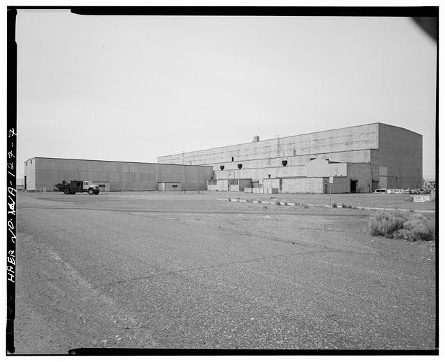 7. 190-D Complex (from left to right, 190-DA, 190-D, tip of 195-D in center). Looking southwest. - D-Reactor Complex, Area 100-D, Richland, Benton County, WA
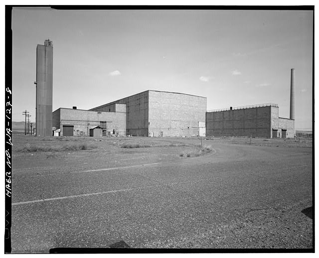 8. 190-D Complex (from left to right, 195-D, 185/189-D, 190-D). Looking northeast. - D-Reactor Complex, Area 100-D, Richland, Benton County, WA
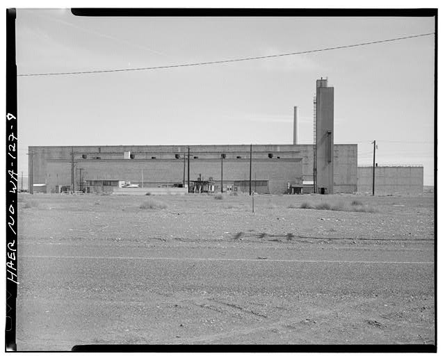 9. 190-D Complex (from front to rear, 195-D, 185/189-D, 190-D). Looking east. - D-Reactor Complex, Area 100-D, Richland, Benton County, WA
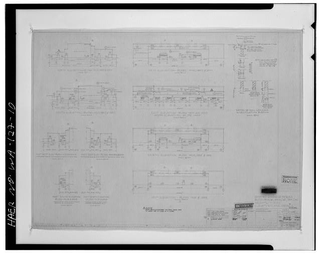 10. Hanford Engineer Works, Bldgs. 190-B, D & F; 185-B, D, & F; 189-D & F. Architectural Elevations and Details, W-71746, 1943. - D-Reactor Complex, Area 100-D, Richland, Benton County, WA
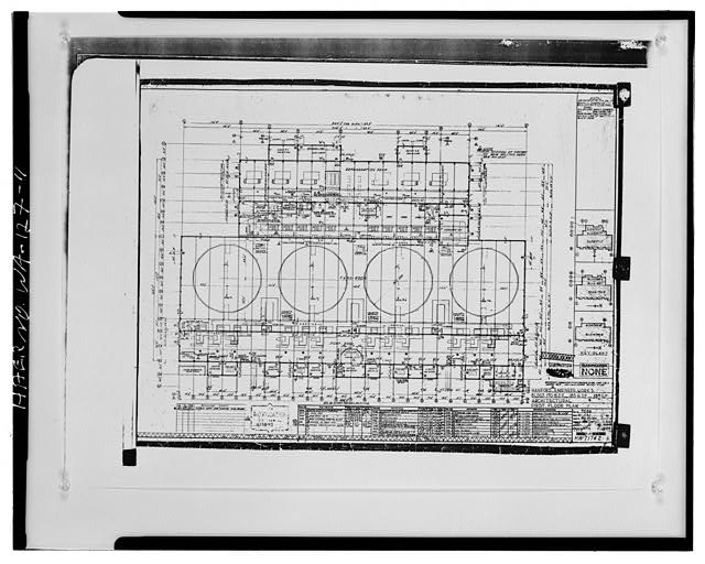 11. Hanford Engineer Works, Bldgs. 190-B, D, F; 185-B, D, F; 189-D, F. Architectural First Floor Plan, HW-71742, 1943. - D-Reactor Complex, Area 100-D, Richland, Benton County, WA
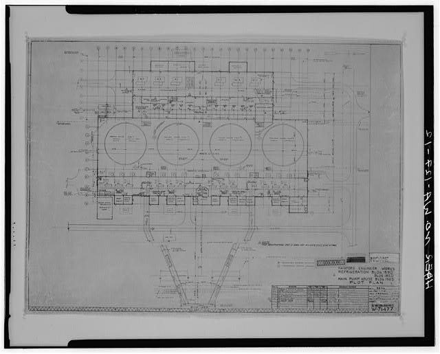 12. Hanford Engineer WOrks, Refigeration Bldg. 189-D, Bldg. 185-D; Main Pump House Bldg. 190-D. Plot Plan, W-71477, 1943. - D-Reactor Complex, Area 100-D, Richland, Benton County, WA
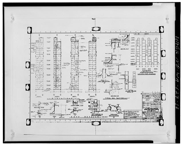 13. V.S.R. Tower, Elevations, Typical Section & Details, H-I-5697, 1957. - D-Reactor Complex, Area 100-D, Richland, Benton County, WA
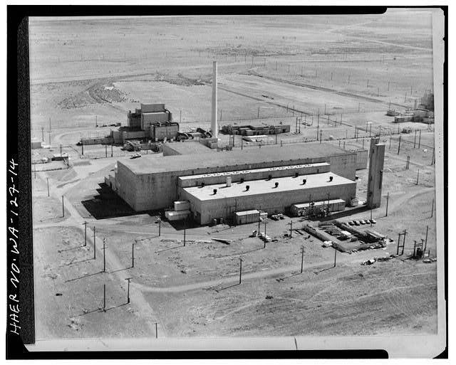 14. Aerial view of the 190-D Complex (foreground) and D-Reactor (background), Looking east, March 1983, Neg. #106669-55. - D-Reactor Complex, Area 100-D, Richland, Benton County, WA
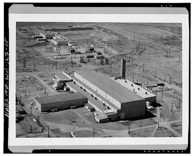 15. Aerial view of 190-D Complex (foreground). Looking south, August 1993, Neg. #93070619-56. - D-Reactor Complex, Area 100-D, Richland, Benton County, WA
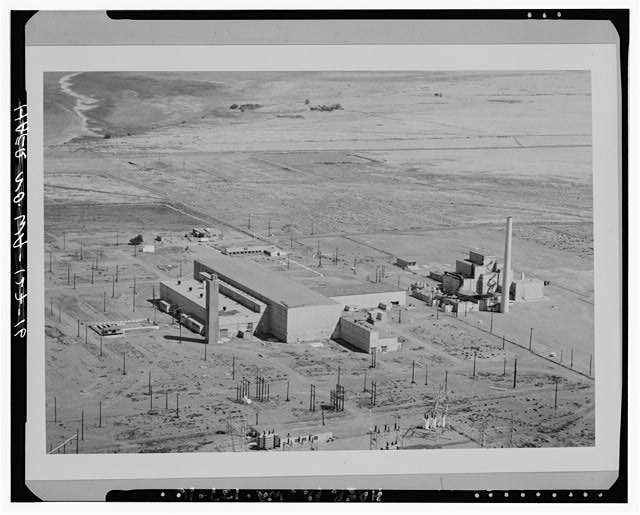 16. Aerial view of 190-D Complex (left) and D-Reactor (right). Looking north, August 1993, Neg. #93070619-62. - D-Reactor Complex, Area 100-D, Richland, Benton County, WA
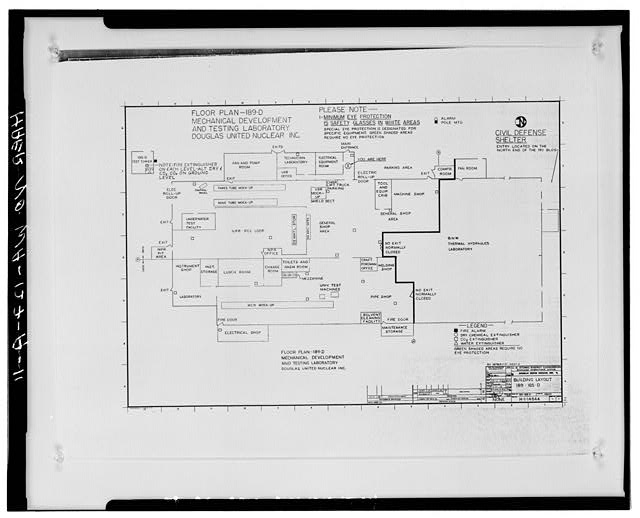 11. Building Layout, 185-189 D, U.S. Atomic Energy Commission, Richland Operations Office, Dwg. No. H-1-14844, 1957. - D-Reactor Complex, Deaeration Plant-Refrigeration Buildings, Area 100-D, Richland, Benton County, WA
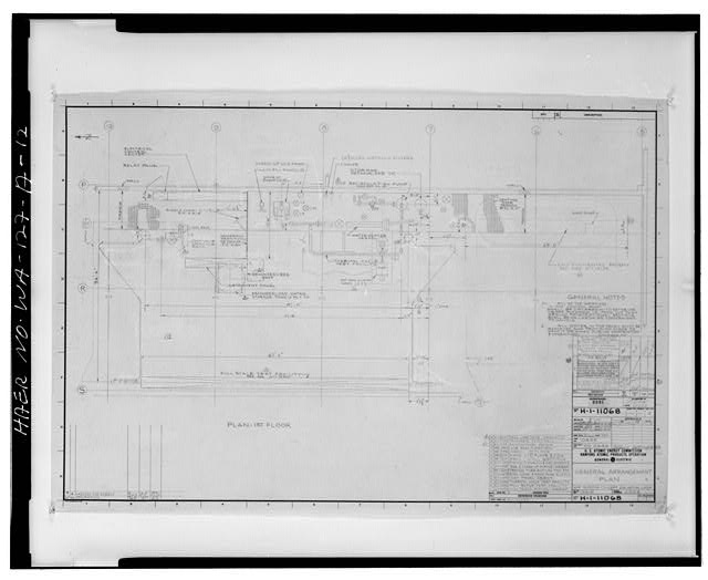 12. General Arrangement Plan, Building 189-D, U.S. Atomic Energy Commission, General Electric Company, Dwg. No. H-1-11068, 1958. - D-Reactor Complex, Deaeration Plant-Refrigeration Buildings, Area 100-D, Richland, Benton County, WA
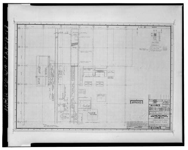 13. Architectural First Floor Plan Buildings 185-189 D, U.S. Atomic Energy Commission, General Electric Company, Dwg. NO. H-1-11825, 1959. - D-Reactor Complex, Deaeration Plant-Refrigeration Buildings, Area 100-D, Richland, Benton County, WA
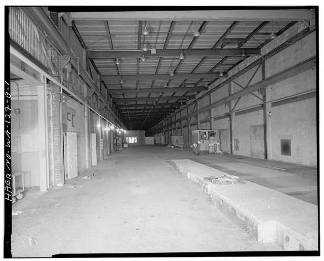 1. Pump Room (low bay), 190-D. Original control room in rear. Looking south. - D-Reactor Complex, Tank Room & Process Pump House, Area 100-D, Richland, Benton County, WA
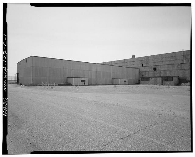 1. 190-DA, north and east facades (east facade of 190-D to the right). Looking southwest. - D-Reactor Complex, Process Water Pumphouse Annex, Area 100-D, Richland, Benton County, WA
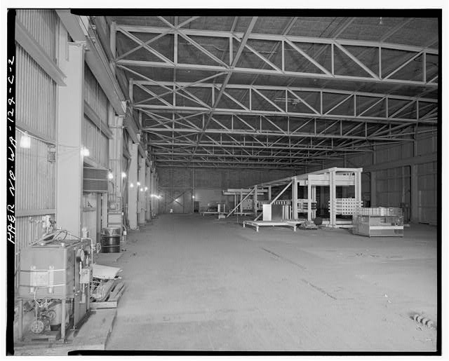 2. 190-DA, interior (mock-up of N-Reactor training equipment in background). Looking west. - D-Reactor Complex, Process Water Pumphouse Annex, Area 100-D, Richland, Benton County, WA
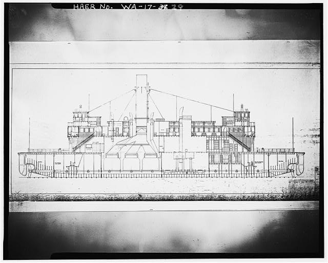 29. BETHLEHEM SHIPBUILDING CORP, LTD. UNION PLANT, SAN FRANCISCO, CA. INBOARD PROFILE, SHEET NUMBER H-5314-11-10. Drawn by A.E. Wilson, undated. - San Mateo Ferry, South end of Lake Union, Seattle, King County, WA
Credits and rights are shown with each photograph. Is one of them yours, or wrongly credited? Open it and use Report a rights issue.