Photographs
879 photographs of the places in the archive's stories: streets, harbours, mills and the people in them. Search them, or narrow by decade and town.
430 photographs · Show them all
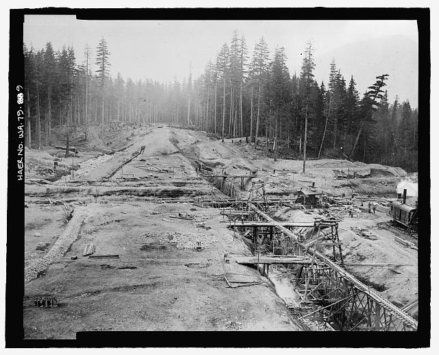 9. Photographic copy of photograph, photographer unknown, 30 September 1911 (original print located at U.S. Bureau of Reclamation Upper Columbia Area Office, Yakima, Washington). "GENERAL VIEW OF DAM SITE TAKEN FROM EAST BANK SHOWING TRESTLE FOR CONCRETE CORE-WALL, TRESTLE FOR CONCRETING DAM CONDUIT, EXCAVATION FOR GLAZED PIPE DRAIN AND IN FOREGROUND ON LEFT SECTION OF SAME COMPLETED" - Kachess Dam, Kachess River, 1.5 miles north of Interstate 90, Easton, Kittitas County, WA
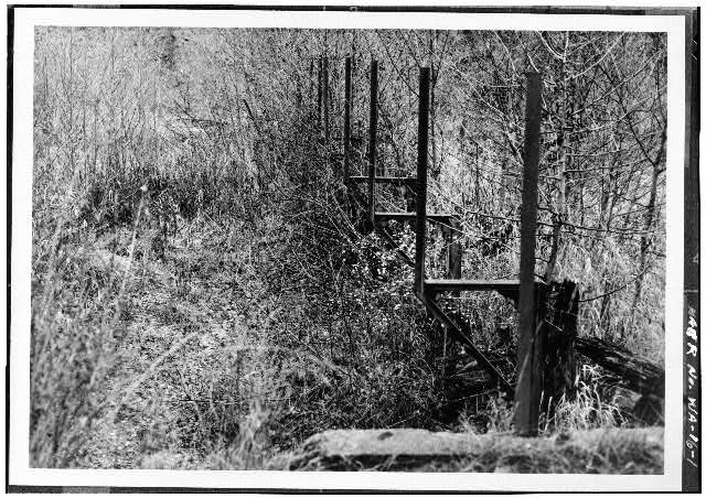 1. VIEW OF THE DIVERSION DAM ON CALISPELL CREEK, LOOKING EAST - Calispell Diversion Canal, 1.2 miles southeast of I-20 & Flowery Trail, Usk, Pend Oreille County, WA
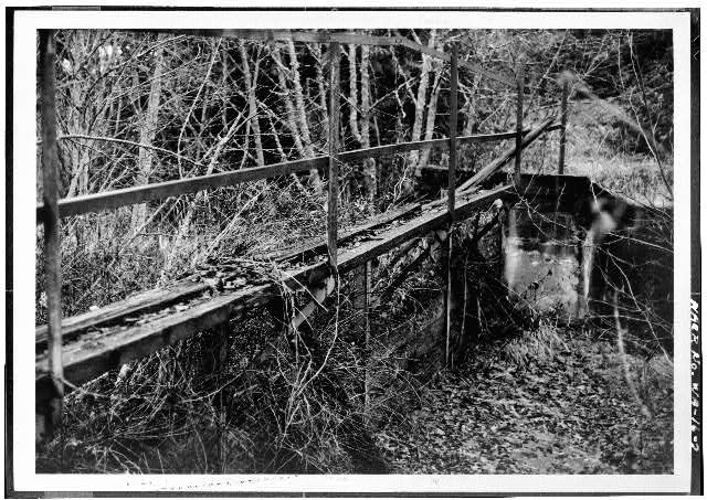 2. VIEW OF HEADGATE AT CALISPELL CREEK, LOOKING SOUTHEAST - Calispell Diversion Canal, 1.2 miles southeast of I-20 & Flowery Trail, Usk, Pend Oreille County, WA
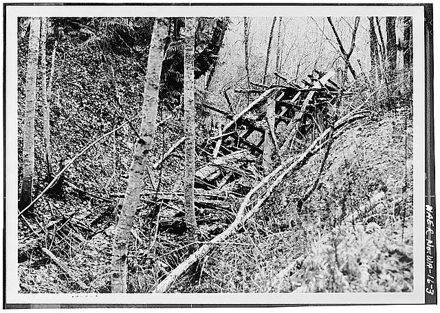 3. VIEW OF FLUME PILINGS AND BRACINGS ON EAST SIDE OF CALISPELL CREEK, LOOKING SOUTHWEST - Calispell Diversion Canal, 1.2 miles southeast of I-20 & Flowery Trail, Usk, Pend Oreille County, WA
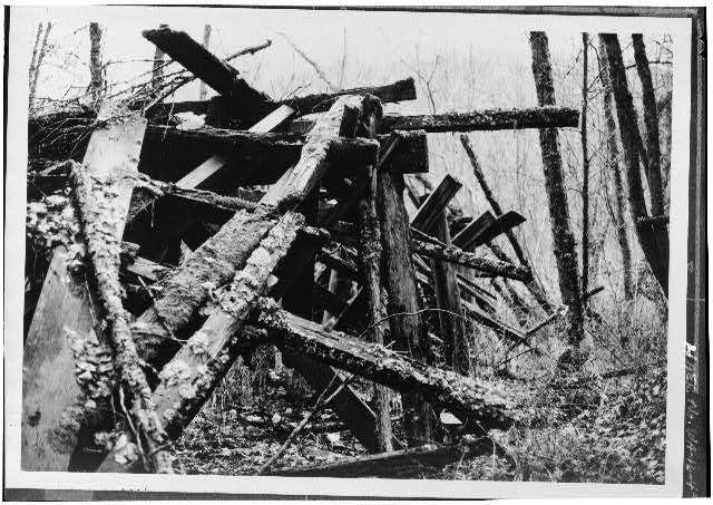 4. CLOSEUP VIEW OF FLUME REMAINS ON EAST SIDE OF CALISPELL CREEK, LOOKING SOUTHWEST - Calispell Diversion Canal, 1.2 miles southeast of I-20 & Flowery Trail, Usk, Pend Oreille County, WA
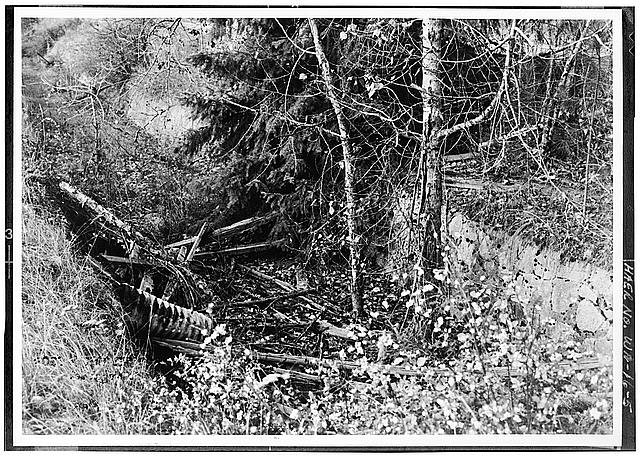 5. VIEW OF ROCK AND CONCRETE LINING ON THE OLD E. J. ZIGLER RANCH, LOOKING NORTH - Calispell Diversion Canal, 1.2 miles southeast of I-20 & Flowery Trail, Usk, Pend Oreille County, WA
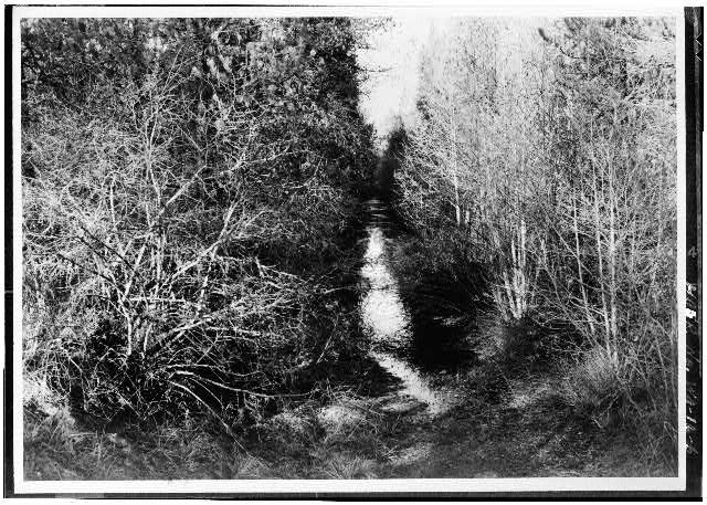 6. VIEW OF TREES AND BRUSH ALONGSIDE CANAL, LOOKING NORTH FROM ROUTE 20 BRIDGE - Calispell Diversion Canal, 1.2 miles southeast of I-20 & Flowery Trail, Usk, Pend Oreille County, WA
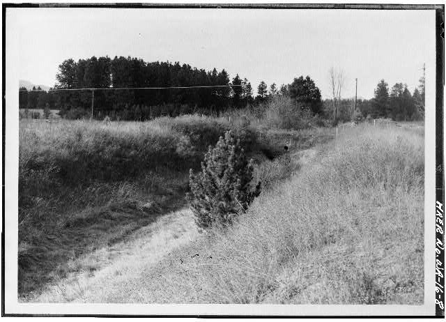 8. TYPICAL VIEW OF DITCH IN ITS LOWER SECTIONS, LOOKING NORTH - Calispell Diversion Canal, 1.2 miles southeast of I-20 & Flowery Trail, Usk, Pend Oreille County, WA
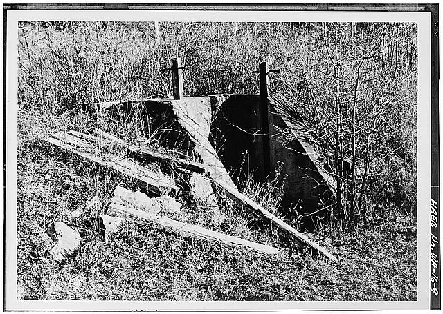 9. TYPICAL VIEW OF MASONRY IRRIGATION TURNOUT WITH FLASHBOARDS LYING ADJACENT, LOOKING SOUTHEAST - Calispell Diversion Canal, 1.2 miles southeast of I-20 & Flowery Trail, Usk, Pend Oreille County, WA
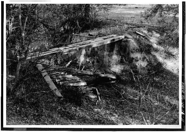 11. TYPICAL VIEW OF A ONE-LANE FARM CROSSING CONSISTING OF MASONRY ABUTMENTS AND LARGE PLANKS, IN THE LOWER SECTION OF THE CANAL, LOOKING NORTH - Calispell Diversion Canal, 1.2 miles southeast of I-20 & Flowery Trail, Usk, Pend Oreille County, WA
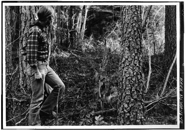 12. VIEW OF THE PROPOSED RAILWAY AND INTAKE/EFFLUENT WATER SUPPLY CORRIDOR THAT WILL CROSS THE DITCH AT THIS LOCATION, LOOKING NORTH - Calispell Diversion Canal, 1.2 miles southeast of I-20 & Flowery Trail, Usk, Pend Oreille County, WA
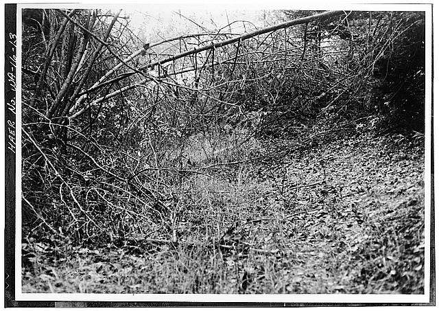 13. VIEW OF THE PROPOSED RAILWAY AND INTAKE/EFFLUENT WATER SUPPLY CORRIDOR THAT WILL CROSS THE DITCH AT THIS LOCATION, LOOKING EAST - Calispell Diversion Canal, 1.2 miles southeast of I-20 & Flowery Trail, Usk, Pend Oreille County, WA
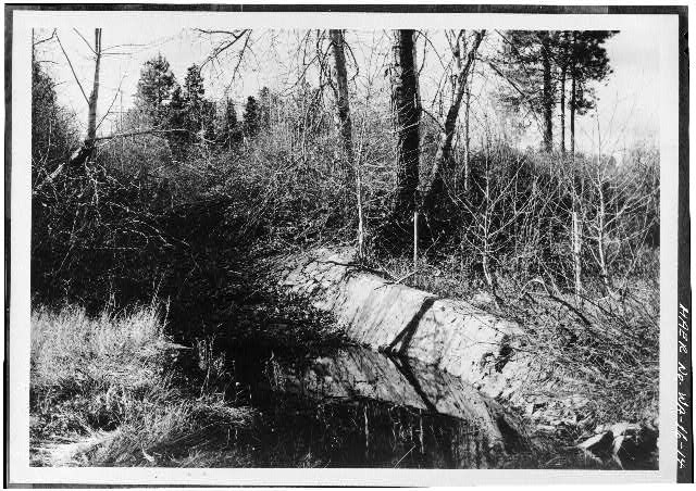 14. VIEW OF THE ROCK AND CONCRETE OUTLET WEIR AND SPILLWAY AT DAVIS CREEK, LOOKING WEST - Calispell Diversion Canal, 1.2 miles southeast of I-20 & Flowery Trail, Usk, Pend Oreille County, WA
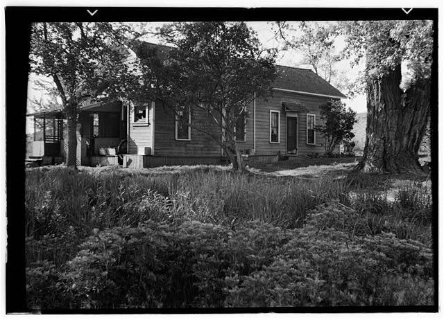 A. J. Splawn House, Cowiche, Yakima County, WA
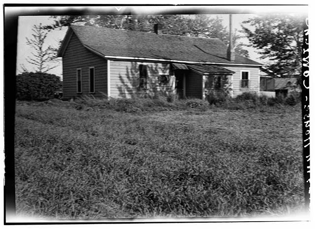 A. J. Splawn House, Cowiche, Yakima County, WA
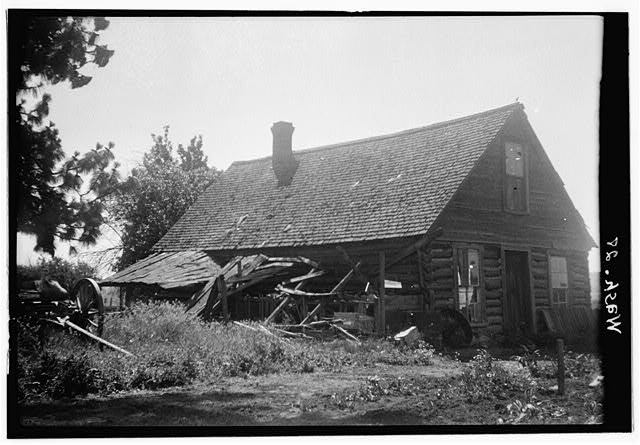 Hazard Post Office, Wild Rose Prairie, Deer Park, Spokane County, WA
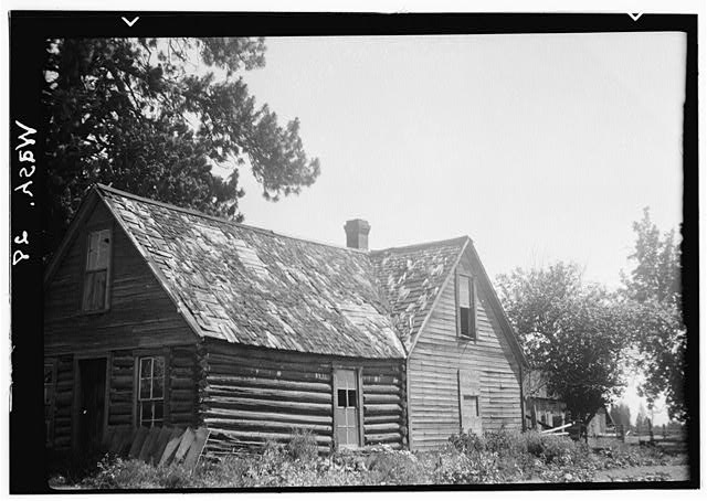 Hazard Post Office, Wild Rose Prairie, Deer Park, Spokane County, WA
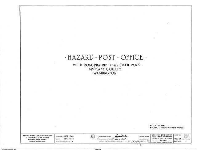 HABS WASH,32-DERP.V,1- (sheet 0 of 3) - Hazard Post Office, Wild Rose Prairie, Deer Park, Spokane County, WA
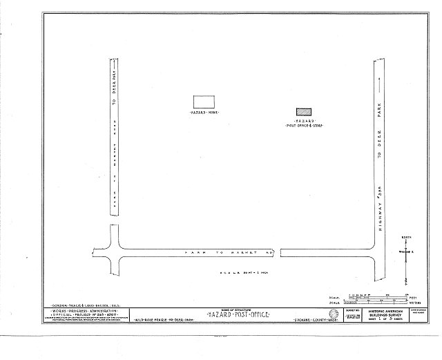 HABS WASH,32-DERP.V,1- (sheet 1 of 3) - Hazard Post Office, Wild Rose Prairie, Deer Park, Spokane County, WA
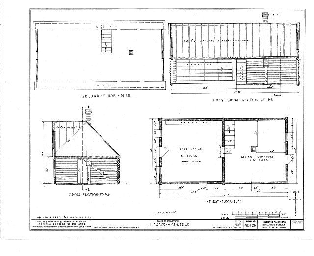 HABS WASH,32-DERP.V,1- (sheet 2 of 3) - Hazard Post Office, Wild Rose Prairie, Deer Park, Spokane County, WA
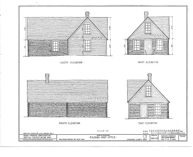 HABS WASH,32-DERP.V,1- (sheet 3 of 3) - Hazard Post Office, Wild Rose Prairie, Deer Park, Spokane County, WA
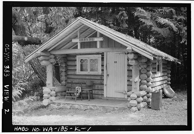 1. VIEW OF SOUTH AND WEST FACADES, LOOKING NORTHEAST. - Rosemary Inn, Dixie Cabin, Olympic National Forest, Barnes Point, Lake Crescent, Port Angeles, Clallam County, WA
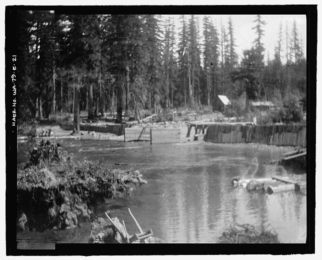 Photographic copy of photograph, G.F.H., photographer, 14 June 1904 (original print located at U.S. Bureau of Reclamation Upper Columbia Area Office, Yakima, Washington). "KACHESS RIVER AT THE MOUTH OF KACHESS LAKE, NEAR EASTON, WASHINGTON. CRIB DAM OF THE CASCADE CANAL CO." - Kachess Dam, 1904 Cascade Canal Company Crib Dam, Kachess River, 1.5 miles north of Interstate 90, Easton, Kittitas County, WA
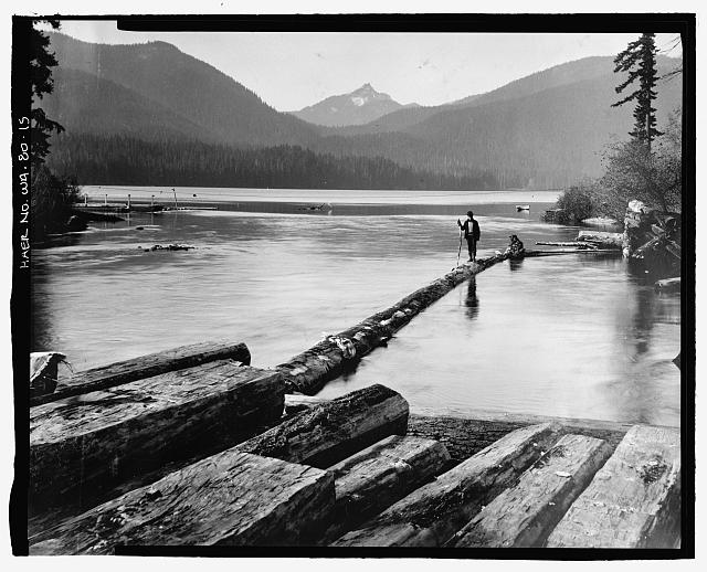 15. Photographic copy of photograph, W. J. Lubken, photographer, 30 October 1905 (original print located at U.S. Bureau of Reclamation Upper Columbia Area Office, Yakima, Washington). "View showing outlet of Keechelus Lake, Washington." - Keechelus Dam, Yakima River, 10 miles northwest of Easton, Easton, Kittitas County, WA
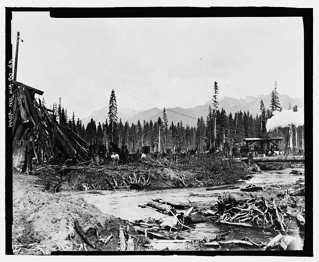 48. Photographic copy of photograph, photographer unknown, 5 September 1916 (original print located at U.S. Bureau of Reclamation Upper Columbia Area Office, Yakima, Washington). "Piling logs with Washington donkey." - Keechelus Dam, Yakima River, 10 miles northwest of Easton, Easton, Kittitas County, WA
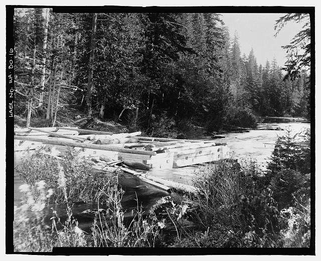 16. Photographic copy of photograph, photographer unknown, 31 October 1905 (original print located at U.S. Bureau of Reclamation Upper Columbia Area Office, Yakima, Washington). "view showing dam in outlet of Keechelus Lake, WN., looking east from right bank at outlet of lake." - Keechelus Dam, Yakima River, 10 miles northwest of Easton, Easton, Kittitas County, WA
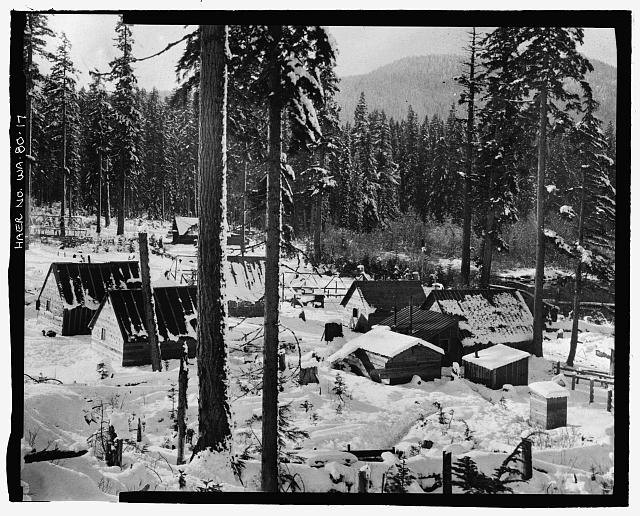 17. Photographic copy of photograph, photographer unknown, 22 November 1906 (original print located at U.S. Bureau of Reclamation Upper Columbia Area Office, Yakima, Washington). "Government camp at foot of lake." - Keechelus Dam, Yakima River, 10 miles northwest of Easton, Easton, Kittitas County, WA
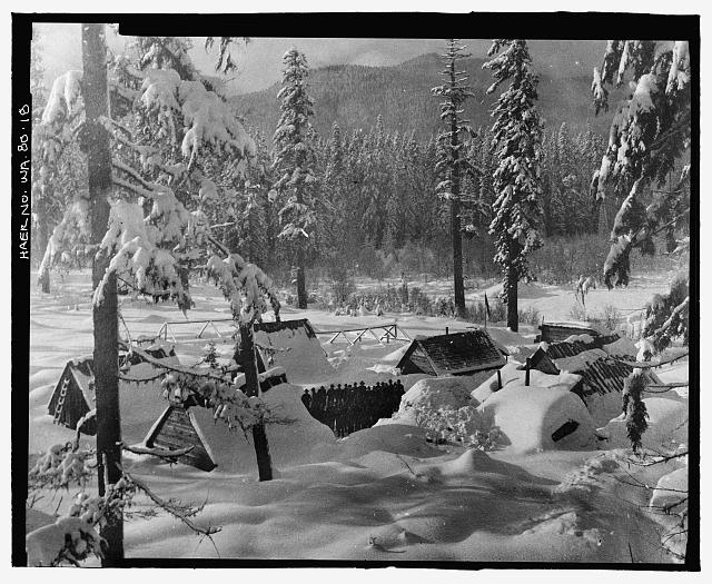 18. Photographic copy of photograph, photographer unknown, 10 January 1907 (original print located at U.S. Bureau of Reclamation Upper Columbia Area Office, Yakima, Washington). "Government camp on right bank of Yakima River." - Keechelus Dam, Yakima River, 10 miles northwest of Easton, Easton, Kittitas County, WA
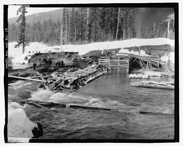 19. Photographic copy of photograph, photographer unknown, 9 February 1907 (original print located at U.S. Bureau of Reclamation Upper Columbia Area Office, Yakima, Washington). "Keechelus Crib Dam. Showing east abutment and freshet". - Keechelus Dam, Yakima River, 10 miles northwest of Easton, Easton, Kittitas County, WA
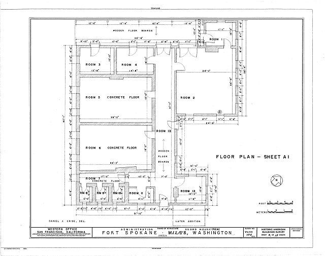 HABS WASH,22-LINC.V,1I- (sheet 1 of 4) - Fort Spokane, New Guardhouse, Lincoln, Lincoln County, WA
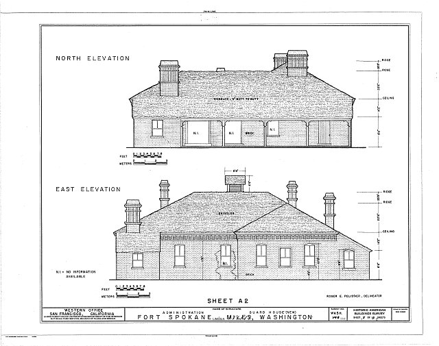 HABS WASH,22-LINC.V,1I- (sheet 2 of 4) - Fort Spokane, New Guardhouse, Lincoln, Lincoln County, WA
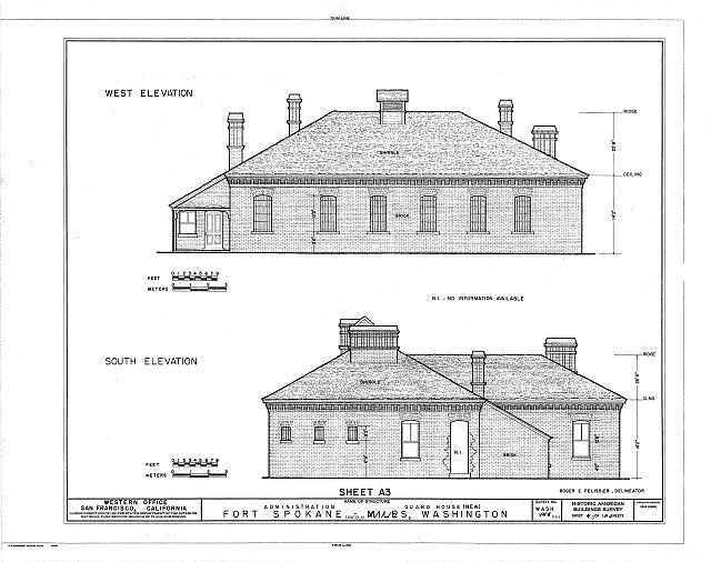 HABS WASH,22-LINC.V,1I- (sheet 3 of 4) - Fort Spokane, New Guardhouse, Lincoln, Lincoln County, WA
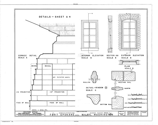 HABS WASH,22-LINC.V,1I- (sheet 4 of 4) - Fort Spokane, New Guardhouse, Lincoln, Lincoln County, WA
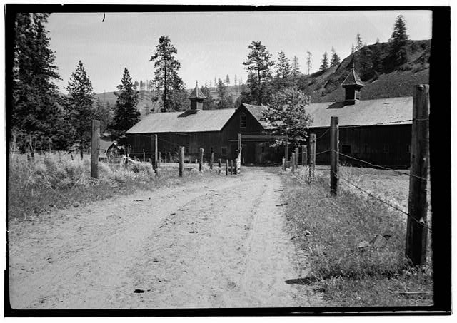 Fort Spokane, Stable Barn, Lincoln, Lincoln County, WA
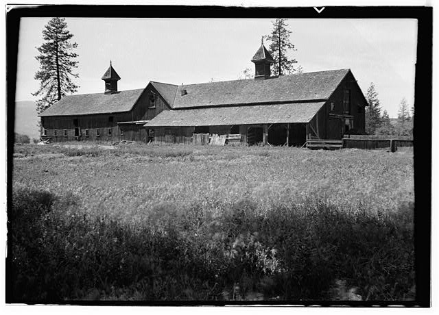 Fort Spokane, Stable Barn, Lincoln, Lincoln County, WA
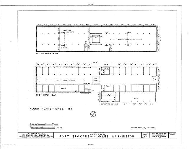 HABS WASH,22-LINC.V,1G- (sheet 1 of 5) - Fort Spokane, Stable Barn, Lincoln, Lincoln County, WA
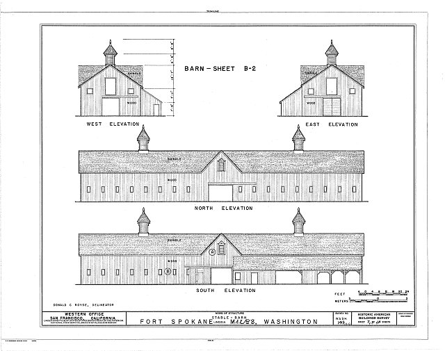 HABS WASH,22-LINC.V,1G- (sheet 2 of 5) - Fort Spokane, Stable Barn, Lincoln, Lincoln County, WA
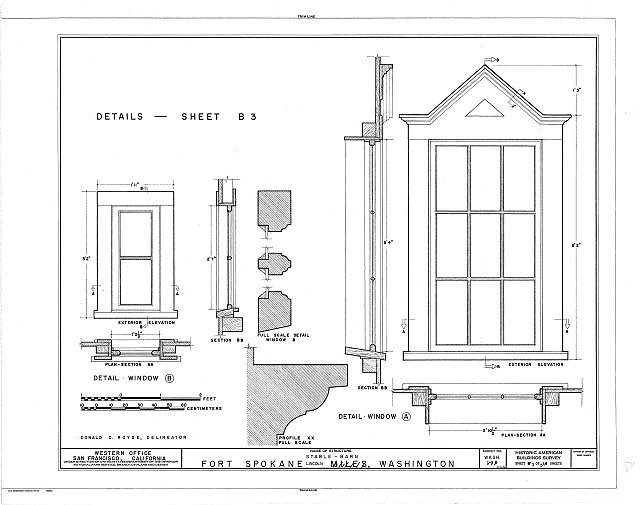 HABS WASH,22-LINC.V,1G- (sheet 3 of 5) - Fort Spokane, Stable Barn, Lincoln, Lincoln County, WA
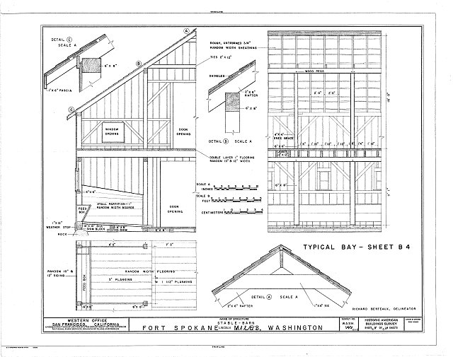 HABS WASH,22-LINC.V,1G- (sheet 4 of 5) - Fort Spokane, Stable Barn, Lincoln, Lincoln County, WA
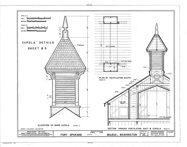 HABS WASH,22-LINC.V,1G- (sheet 5 of 5) - Fort Spokane, Stable Barn, Lincoln, Lincoln County, WA
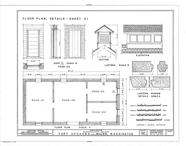 HABS WASH,22-LINC.V,1J- (sheet 1 of 2) - Fort Spokane, Quartermaster Building, Lincoln, Lincoln County, WA
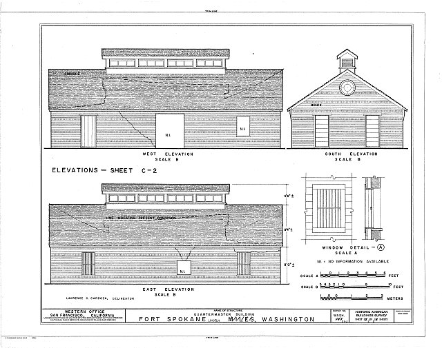 HABS WASH,22-LINC.V,1J- (sheet 2 of 2) - Fort Spokane, Quartermaster Building, Lincoln, Lincoln County, WA
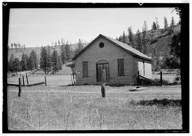 Fort Spokane, Powder Magazine, Lincoln, Lincoln County, WA
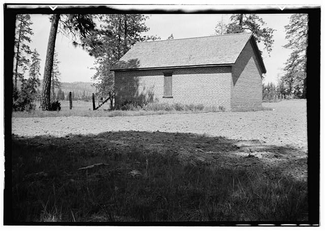 Fort Spokane, Powder Magazine, Lincoln, Lincoln County, WA
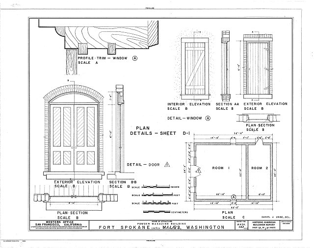 HABS WASH,22-LINC.V,1D- (sheet 1 of 2) - Fort Spokane, Powder Magazine, Lincoln, Lincoln County, WA
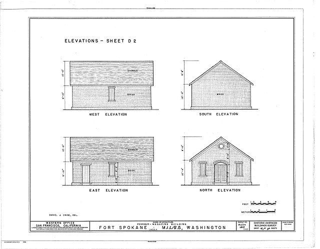 HABS WASH,22-LINC.V,1D- (sheet 2 of 2) - Fort Spokane, Powder Magazine, Lincoln, Lincoln County, WA
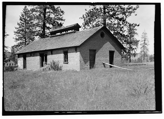 Fort Spokane, Old Guardhouse, Lincoln, Lincoln County, WA
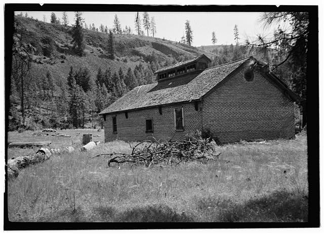 Fort Spokane, Old Guardhouse, Lincoln, Lincoln County, WA
Credits and rights are shown with each photograph. Is one of them yours, or wrongly credited? Open it and use Report a rights issue.