Photographs
879 photographs of the places in the archive's stories: streets, harbours, mills and the people in them. Search them, or narrow by decade and town.
430 photographs · Show them all
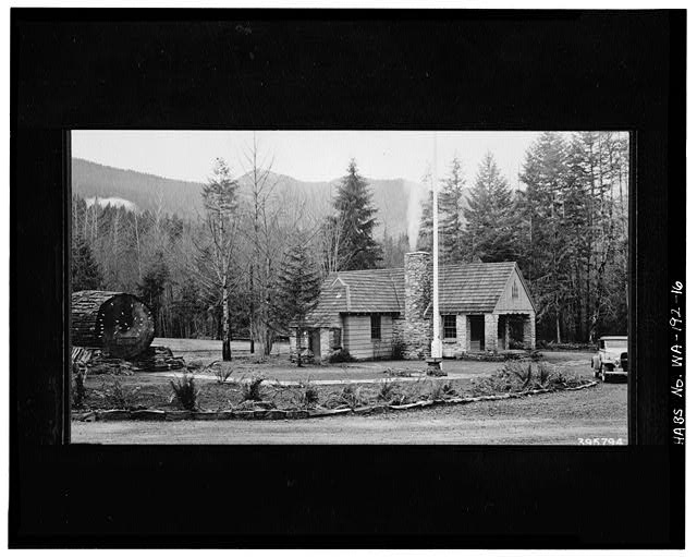 16. Photocopy of photograph (4 x 5 inch reduction of 1939 3-1/4 x 5-5/8 inch print, photographer unknown; in Recreation files, Supervisor's Office, Mt. Baker-Snoqualmie National Forest) GENERAL VIEW, NORTHEAST CORNER, INTERPRETIVE LOG TO LEFT. - Glacier Ranger Station, Washington State Route 542, Glacier, Whatcom County, WA
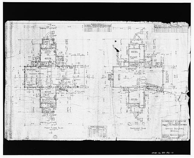 17. Photocopy of drawing (8 x 10 inch reduction of undated 24 x 36 inch blueprint; in Engineering files, Mt. Baker Ranger District, Sedro-Woolley) OFFICE BUILDING, SPECIAL; SHEET 1 OF 5; FIRST FLOOR AND BASEMENT PLANS - Glacier Ranger Station, Washington State Route 542, Glacier, Whatcom County, WA
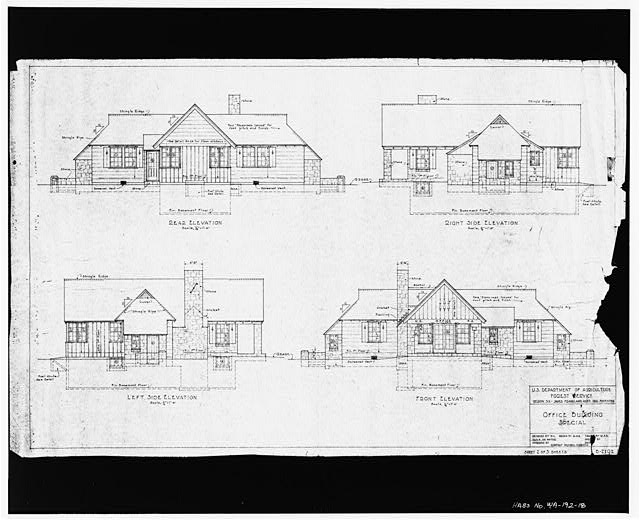 18. Photocopy of drawing (8 x 10 inch reduction of undated 24 x 36 inch blueprint; in Engineering files, Mt. Baker Ranger District, Sedro-Woolley) OFFICE BUILDING, SPECIAL; SHEET 2 OF 5; ELEVATIONS - Glacier Ranger Station, Washington State Route 542, Glacier, Whatcom County, WA
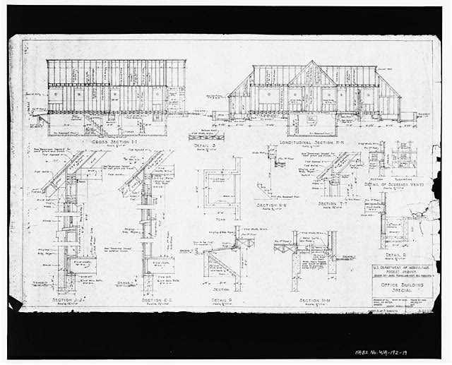 19. Photocopy of drawing (8 x 10 inch reduction of undated 24 x 36 inch blueprint; in Engineering files, Mt. Baker Ranger District, Sedro-Woolley) OFFICE BUILDING, SPECIAL; SHEET 3 OF 5; FRAMING DETAILS - Glacier Ranger Station, Washington State Route 542, Glacier, Whatcom County, WA
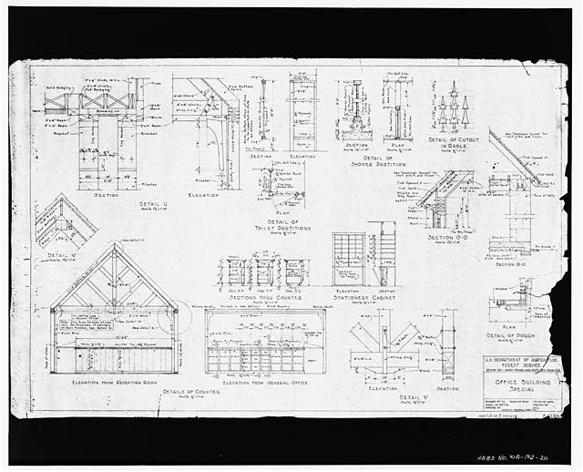 20. Photocopy of drawing (8 x 10 inch reduction of undated 24 x 36 inch blueprint; in Engineering files, Mt. Baker Ranger District, Sedro-Woolley) OFFICE BUILDING, SPECIAL; SHEET 4 OF 5; TRUSS, EXTERIOR TRIM AND CABINET DETAILS - Glacier Ranger Station, Washington State Route 542, Glacier, Whatcom County, WA
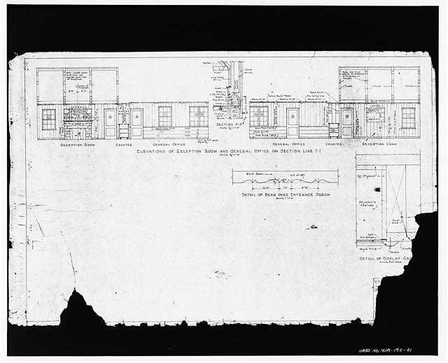 21. Photocopy of drawing (8 x 10 inch reduction of undated 24 x 36 inch blueprint; in Engineering files, Mt. Baker Ranger District, Sedro-Woolley) OFFICE BUILDING, SPECIAL; SHEET 5 OF 5; INTERIOR FINISH DETAILS - Glacier Ranger Station, Washington State Route 542, Glacier, Whatcom County, WA
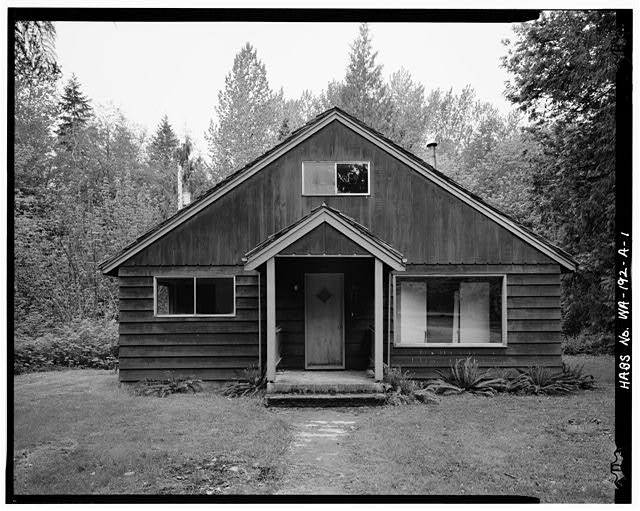 1. July 1988 EAST (MAIN) ELEVATION, PROTECTION ASSISTANT'S RESIDENCE (BUILDING 1092) - Glacier Ranger Station, Protection Assistant's Residence, Washington State Route 542, Glacier, Whatcom County, WA
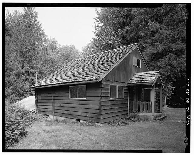 2. July 1988 SOUTHEAST CORNER, PROTECTION ASSISTANT'S RESIDENCE (BUILDING 1092) - Glacier Ranger Station, Protection Assistant's Residence, Washington State Route 542, Glacier, Whatcom County, WA
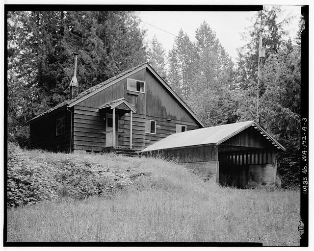 3. July 1988 NORTHWEST CORNER, PROTECTION ASSISTANT'S RESIDENCE (BUILDING 1092) - Glacier Ranger Station, Protection Assistant's Residence, Washington State Route 542, Glacier, Whatcom County, WA
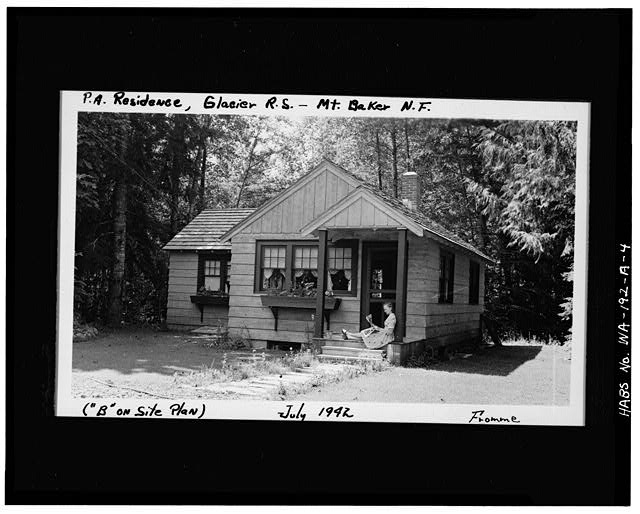 4. Photocopy of photograph (4 x 5 inch enlargement of 1942 3-1/2 x 5-7/8 inch print by R. Fromme; in Recreation files, Supervisor's Office, Mt. Baker-Snoqualmie National Forest) EAST (MAIN) ELEVATION OF PROTECTION ASSISTANT'S RESIDENCE - Glacier Ranger Station, Protection Assistant's Residence, Washington State Route 542, Glacier, Whatcom County, WA
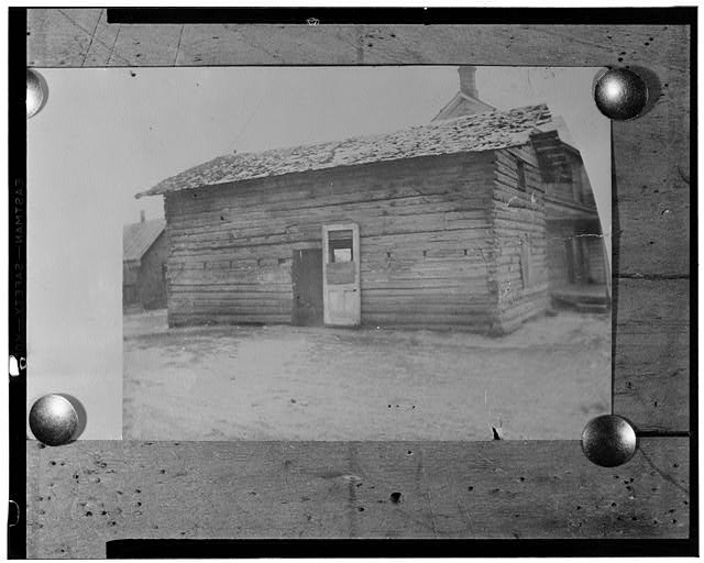 Goldendale Blockhouse, Courthouse Park (moved from original location), Goldendale, Klickitat County, WA
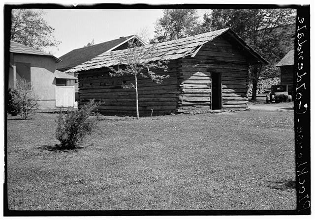 Goldendale Blockhouse, Courthouse Park (moved from original location), Goldendale, Klickitat County, WA
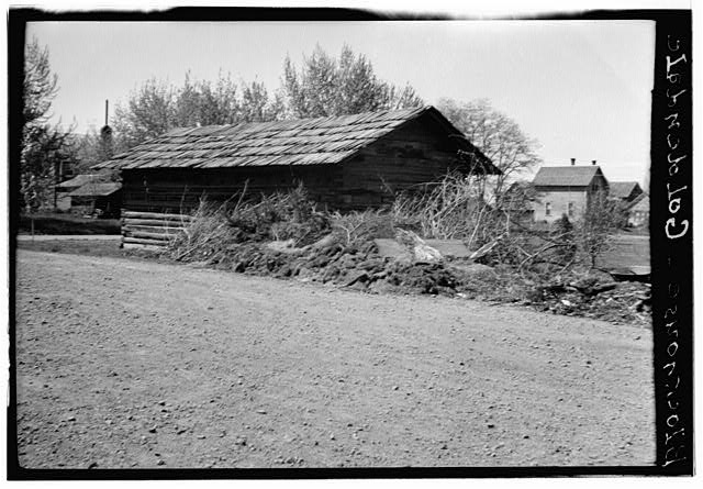 Goldendale Blockhouse, Courthouse Park (moved from original location), Goldendale, Klickitat County, WA
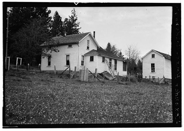 Alexander House, Goldendale, Klickitat County, WA
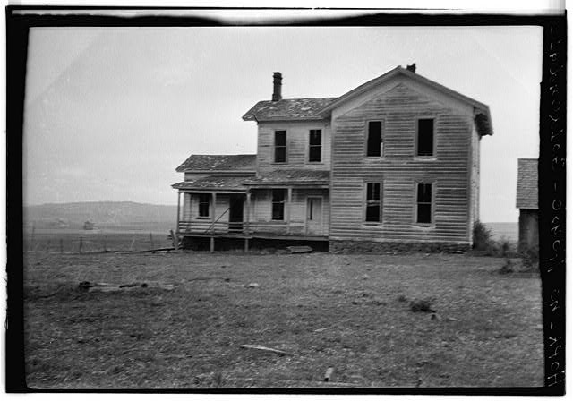 Hopkins House & Barn, Goldendale, Klickitat County, WA
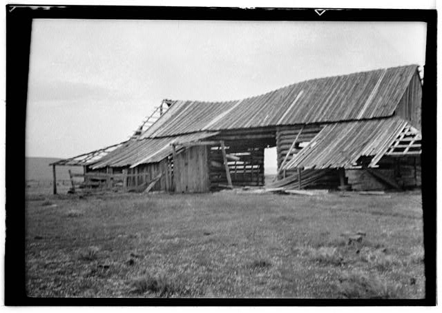 Hopkins House & Barn, Goldendale, Klickitat County, WA
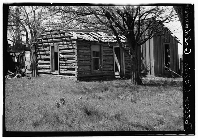 Myron Potter Cabin, Goldendale, Klickitat County, WA
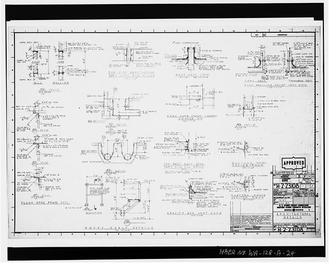 24. Plutonium Recovery From Contaminated Materials, Architectural Details, Building 232-z, U.S. Atomic Energy Commission, Hanford Atomic Products Operation, General Electric Company, Dwg. No. H-2-23106, 1959. - Plutonium Finishing Plant, Waste Incinerator Facility, 200 West Area, Richland, Benton County, WA
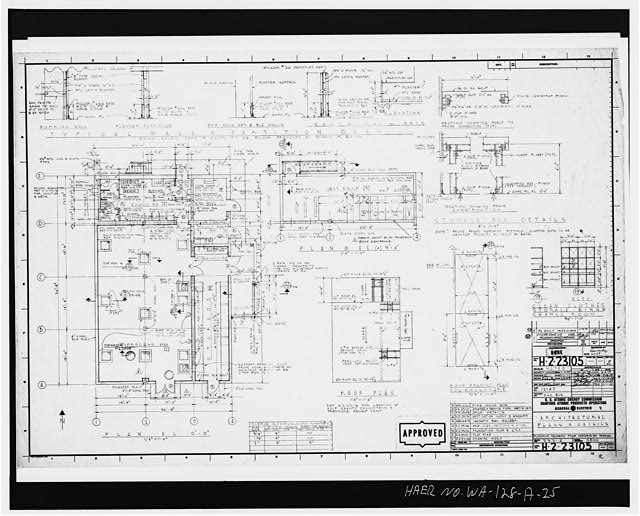 25. Plutonium Recovery From Contaminated Materials, Architectural Plans & Details, Building 232-Z, U.S. Atomic Energy Commission, Hanford Atomic Products Operation, General Electric Company, Dwg. No. H-2-23105, 1959. - Plutonium Finishing Plant, Waste Incinerator Facility, 200 West Area, Richland, Benton County, WA
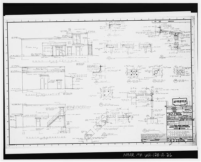 26. Plutonium Recovery From Contaminated Materials, Architectural Elevations, Sections & Dets., Building 232-Z, U.S. Atomic Energy Commission, Hanford Atomic Products Operation, General Electric Company, Dwg. No. H-2-23106, 1959. - Plutonium Finishing Plant, Waste Incinerator Facility, 200 West Area, Richland, Benton County, WA
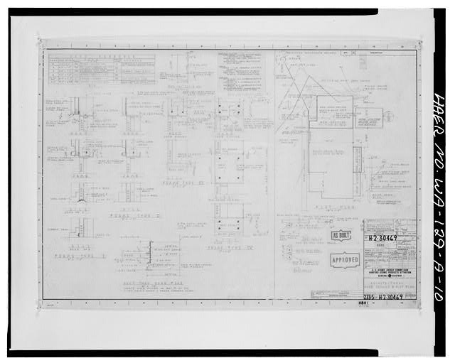 10. Architectural Door Details & Plot Plan, 233-S, U.S. Atomic Energy Commission, Hanford Atomic Products Operations, General Electric Company, Dwg. No. H-2-30469, 1956. - Reduction-Oxidation Complex, Plutonium Concentration Facility, 200 West Area, Richland, Benton County, WA
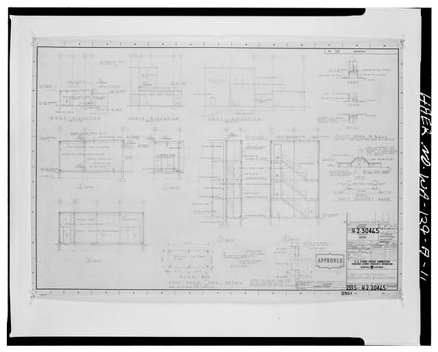 11. Architectural ELevations & Sections, 233-S, U.S. Atomic Energy Commission, Hanford Atomic Products Operations, General Electric Company, Dwg. No. H-2-30465, 1956. - Reduction-Oxidation Complex, Plutonium Concentration Facility, 200 West Area, Richland, Benton County, WA
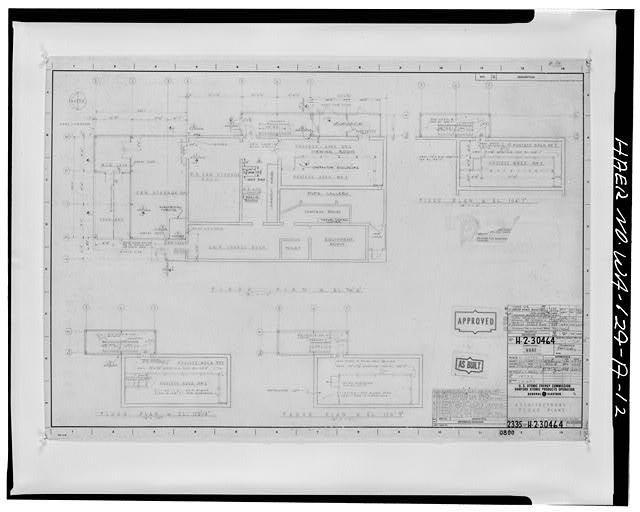 12. Architectural Floor Plans, 233-S, U.S. Atomic Energy Commission, Hanford Atomic Products Operations, General Electric Company, Dwg. H-2-30464, 1956. - Reduction-Oxidation Complex, Plutonium Concentration Facility, 200 West Area, Richland, Benton County, WA
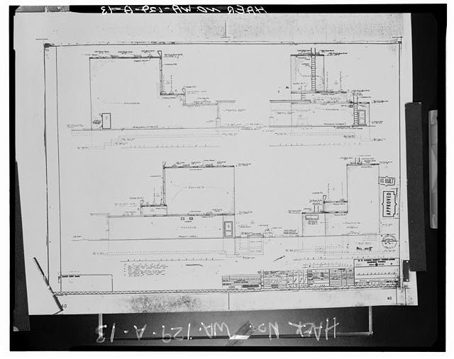 13. Elevations, 233-S, U.S. Atomic Energy Commission, Hanford Works, General Electric Company, Dwg. No. H-2-7203, 1956. - Reduction-Oxidation Complex, Plutonium Concentration Facility, 200 West Area, Richland, Benton County, WA
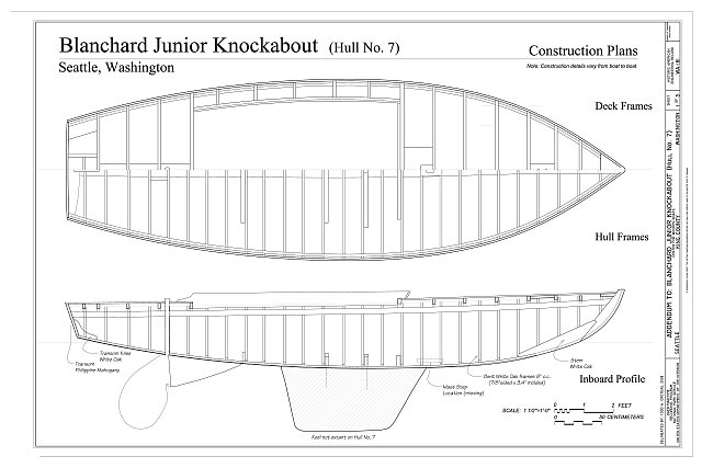 Blanchard Junior Knockabout (Hull No. 7), Construction Plans - Blanchard Junior Knockabout, Hull No. 7, The Center for Wooden Boats, Seattle, King County, WA
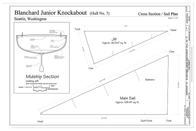 Blanchard Junior Knockabout (Hull No. 7), Cross Section/ Sail Plan - Blanchard Junior Knockabout, Hull No. 7, The Center for Wooden Boats, Seattle, King County, WA
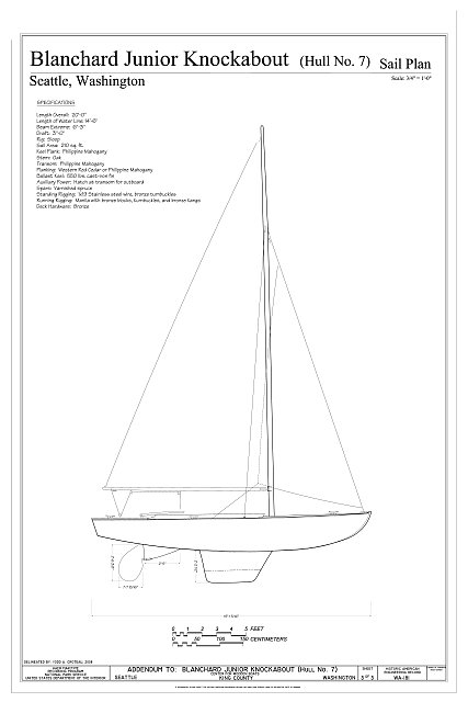 Blanchard Junior Knockabout (Hull No. 7) Sail Plan - Blanchard Junior Knockabout, Hull No. 7, The Center for Wooden Boats, Seattle, King County, WA
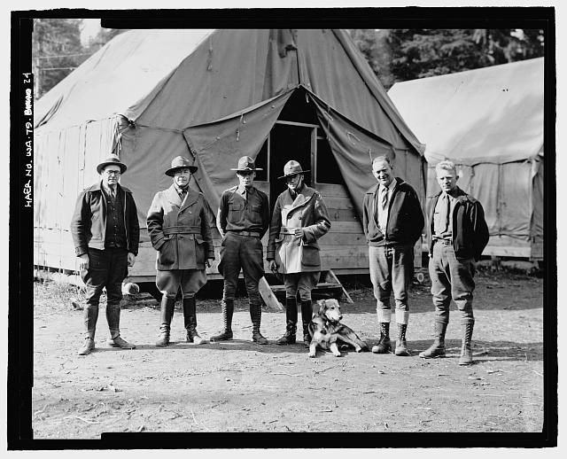 24. Photographic copy of photograph, B.G. James, photographer, 15 October 1935 (original print located at National Archives and Records Center, Denver, Colorado). "PERSONNEL IN CONNECTION WITH WORK. LEFT TO RIGHT - PAUL TAYLOR (BUREAU), CAPTAIN ORDWAY (ARMY), LIEUT. MCCALL (ARMY), LIEUT. LAWSON (ARMY), CAMP SUPT H.E. HOLMAN, MECHANIC WM. PROCTOR [WHO SUPERVISED CCC WORKERS]" - Kachess Dam, Kachess River, 1.5 miles north of Interstate 90, Easton, Kittitas County, WA
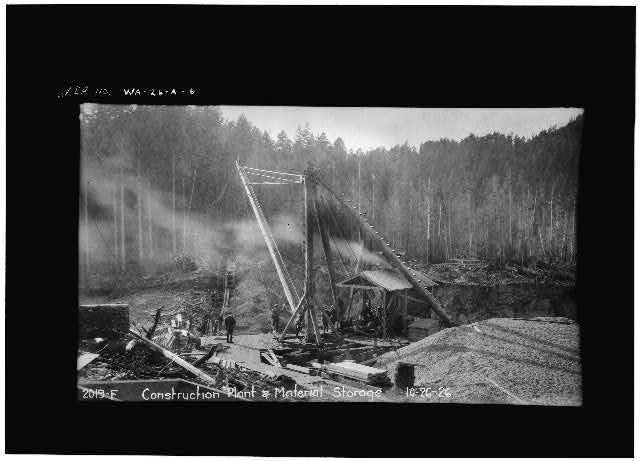 6. Photocopy of historic photograph: VIEW OF CONSTRUCTION PLANT AND EXCAVATION FOR CUTOFF TRENCH FROM EAST SIDE OF APRON EXCAVATION, FACING WEST. October 1926 (Original print located at City of Tacoma, Department of Public Utilities, Light Division, Tacoma, Washington. Photographer unknown) - Cushman No. 1 Hydroelectric Power Plant, Spillway, North Fork of Skokomish River, 5 miles West of Hood Canal, Hoodsport, Mason County, WA
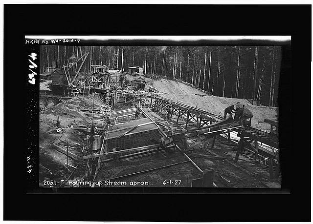 7. Photocopy of historic photograph: VIEW OF POURING UPSTREAM PORTION OF SPILLWAY APRON FROM WEST SIDE OF APRON, FACING EAST. April 1927 (Original print located at City of Tacoma, Department of Public Utilities, Light Division, Tacoma, Washington. Photographer unknown) - Cushman No. 1 Hydroelectric Power Plant, Spillway, North Fork of Skokomish River, 5 miles West of Hood Canal, Hoodsport, Mason County, WA
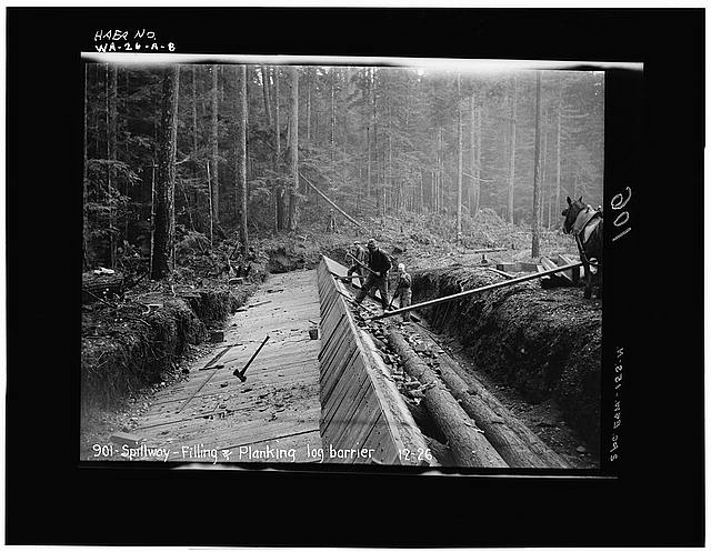 8. Photocopy of historic photograph: VIEW OF FILLING AND PLANKING LOG CRIB DAM FROM EASTERN EXTENT OF DAM, FACING WEST. December 1926 (Original print located at City of Tacoma, Department of Public Utilities, Light Division, Tacoma, Washington. Photographer unknown) - Cushman No. 1 Hydroelectric Power Plant, Spillway, North Fork of Skokomish River, 5 miles West of Hood Canal, Hoodsport, Mason County, WA
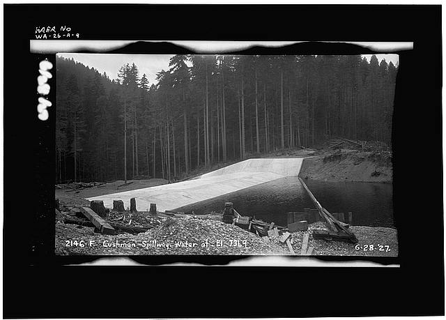 9. Photocopy of historic photograph: VIEW OF COMPLETED SPILLWAY CREST WITH WATER AT ELEVATION 731.9 FROM NORTHEAST SIDE OF STRUCTURE, FACING SOUTHWEST. June 1927 (Original print located at City of Tacoma, Department of Public Utilities, Light Division, Tacoma, Washington. Photographer unknown) - Cushman No. 1 Hydroelectric Power Plant, Spillway, North Fork of Skokomish River, 5 miles West of Hood Canal, Hoodsport, Mason County, WA
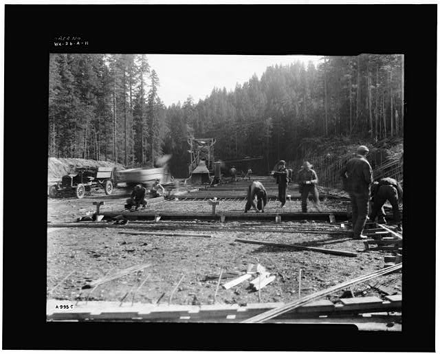 11. Photocopy of historic photograph: VIEW OF PLACING STEEL FOR POURING OF FIRST SLABS OF SPILLWAY CHUTE FROM VICINITY OF WESTERN SIDE OF SPILLWAY APRON, FACING SOUTH. September 1928 (Original print located at City of Tacoma, Department of Public Utilities, Light Division, Tacoma, Washington. Photographer unknown) - Cushman No. 1 Hydroelectric Power Plant, Spillway, North Fork of Skokomish River, 5 miles West of Hood Canal, Hoodsport, Mason County, WA
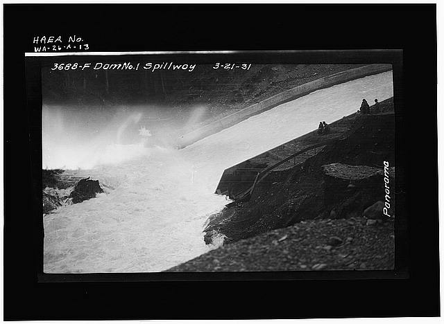 13. Photocopy of historic photograph: VIEW OF DISCHARGE OVER SPILLWAY AT DOWNSTREAM END FROM BANK ON EAST SIDE, FACING NORTHWEST. March 1931 (Original print located at City of Tacoma, Department of Public Utilities, Light Division, Tacoma, Washington. Photographer unknown) - Cushman No. 1 Hydroelectric Power Plant, Spillway, North Fork of Skokomish River, 5 miles West of Hood Canal, Hoodsport, Mason County, WA
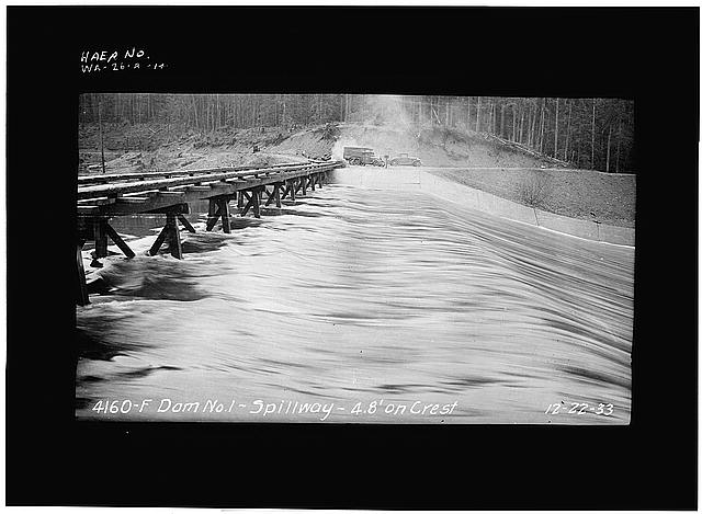 14. Photocopy of historic photograph: VIEW OF DISCHARGE OVER SPILLWAY CREST FROM WEST RETAINING WALL, FACING EAST. WATER ELEVATION MEASURED 4.8 FEET ABOVE CREST. December 1933 (Original print located at City of Tacoma, Department of Public Utilities, Light Division, Tacoma, Washington. Photographer unknown) - Cushman No. 1 Hydroelectric Power Plant, Spillway, North Fork of Skokomish River, 5 miles West of Hood Canal, Hoodsport, Mason County, WA
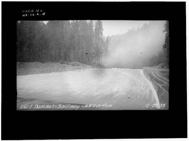 15. Photocopy of historic photograph: VIEW OF DISCHARGE THROUGH SPILLWAY CHUTE FROM WEST RETAINING WALL, FACING SOUTH. STANDING WAVES ARE VISIBLE. WATER ELEVATION MEASURED 4.8 FEET ABOVE CREST. December 1933 (Original print located at City of Tacoma, Department of Public Utilities, Light Division, Tacoma, Washington. Photographer unknown) - Cushman No. 1 Hydroelectric Power Plant, Spillway, North Fork of Skokomish River, 5 miles West of Hood Canal, Hoodsport, Mason County, WA
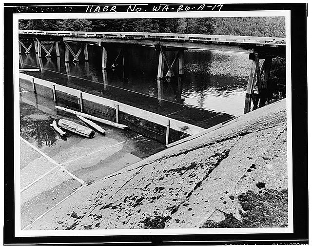 17. Photocopy of historic photograph: VIEW OF FLASHBOARDS AT SPILLWAY CREST WITH WATER RETAINED BEHIND FLASHBOARDS FROM EAST RETAINING WALL, FACING WEST. TRESTLE BRIDGE ALSO IS VIABLE. June 1980 (Original print located at City of Tacoma, Department of Public Utilities, Light Division, Tacoma, Washington. Photographer unknown) - Cushman No. 1 Hydroelectric Power Plant, Spillway, North Fork of Skokomish River, 5 miles West of Hood Canal, Hoodsport, Mason County, WA
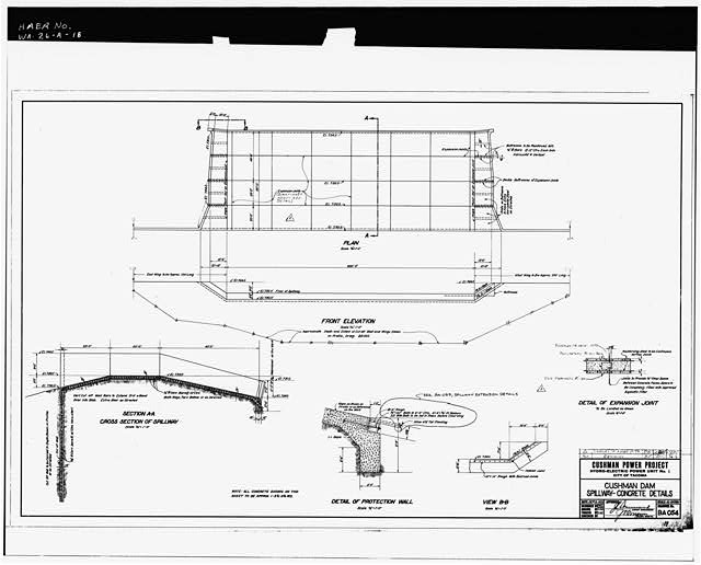 18. Photocopy of engineering drawing: CUSHMAN DAM SPILLWAY - CONCRETE DETAILS. September 1926 Revised in June 1980. Reference No. BA-054 (Original drawing located at City of Tacoma, Department of Public Utilities, Light Division, Tacoma, Washington) - Cushman No. 1 Hydroelectric Power Plant, Spillway, North Fork of Skokomish River, 5 miles West of Hood Canal, Hoodsport, Mason County, WA
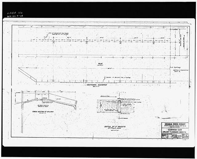 19. Photocopy of engineering drawing: CUSHMAN DAM SPILLWAY - FLASHBOARD SOCKETS. March 1927 Reference No. BA-056 (Original drawing located at City of Tacoma, Department of Public Utilities, Light Division, Tacoma, Washington) - Cushman No. 1 Hydroelectric Power Plant, Spillway, North Fork of Skokomish River, 5 miles West of Hood Canal, Hoodsport, Mason County, WA
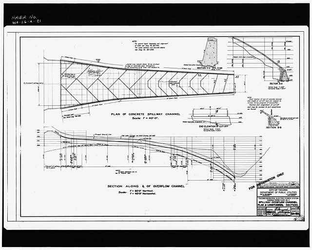 21. Photocopy of engineering drawing: SPILLWAY OVERFLOW CHANNEL PLAN AND LONGITUDINAL SECTION. May 1928. Revised in December 1930, June 1980. Reference No. BA-058 (Original drawing located at City of Tacoma, Department of Public Utilities, Light Division, Tacoma, Washington) - Cushman No. 1 Hydroelectric Power Plant, Spillway, North Fork of Skokomish River, 5 miles West of Hood Canal, Hoodsport, Mason County, WA
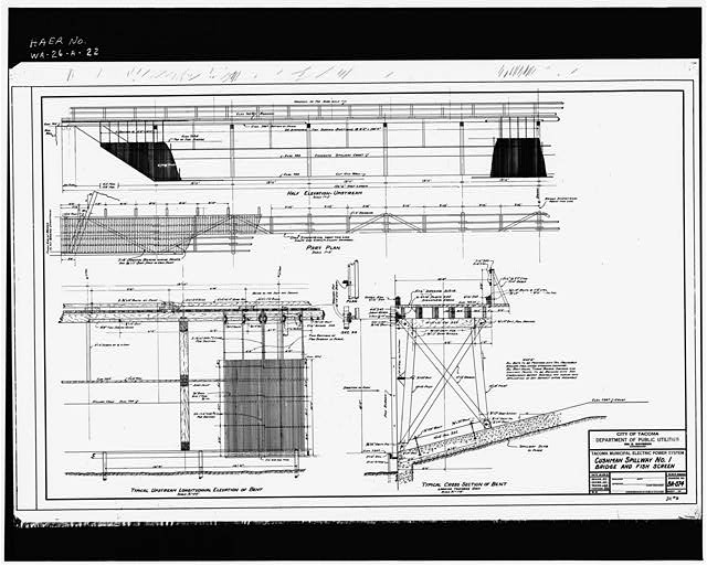 22. Photocopy of engineering drawing: CUSHMAN SPILLWAY NO. 1 BRIDGE AND FISH SCREEN. October 1931 Reference No. BA-074 (Original drawing located at City of Tacoma, Department of Public Utilities, Light Division, Tacoma, Washington) - Cushman No. 1 Hydroelectric Power Plant, Spillway, North Fork of Skokomish River, 5 miles West of Hood Canal, Hoodsport, Mason County, WA
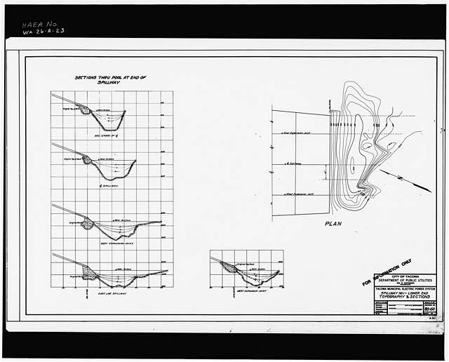 23. Photocopy of engineering drawing: SPILLWAY NO. 1 - LOWER END TOPOGRAPHY AND SECTIONS. February 1934. Reference BS-150. (Original drawing located at City of Tacoma, Department of Public Utilities, Light Division, Tacoma, Washington) - Cushman No. 1 Hydroelectric Power Plant, Spillway, North Fork of Skokomish River, 5 miles West of Hood Canal, Hoodsport, Mason County, WA
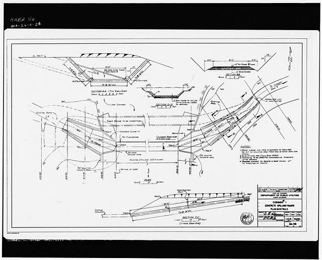 24. Photocopy of engineering drawing: CUSHMAN #1 CONCRETE SPILLWAY RAMPS PLAN AND DETAILS. January 1981. Revised in June 1981. Reference No. BA-081 (Original drawing located at City of Tacoma, Department of Public Utilities, Light Division, Tacoma, Washington) - Cushman No. 1 Hydroelectric Power Plant, Spillway, North Fork of Skokomish River, 5 miles West of Hood Canal, Hoodsport, Mason County, WA
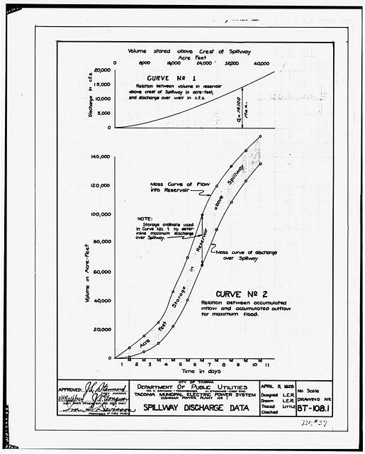 25. Photocopy of engineering drawing: SPILLWAY DISCHARGE DATA. CURVE NO. 1 AND NO. 2. April 1928 Reference No. BT-108.1 (Original drawing located at City of Tacoma, Department of Public Utilities, Light Division, Tacoma, Washington) - Cushman No. 1 Hydroelectric Power Plant, Spillway, North Fork of Skokomish River, 5 miles West of Hood Canal, Hoodsport, Mason County, WA
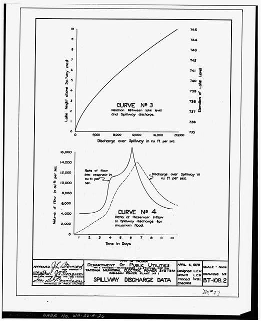 26. Photocopy of engineering drawing: SPILLWAY DISCHARGE DATA. CURVE NO. 3 AND NO. 4. April 1928 Reference No. 108.2 (Original drawing located at City of Tacoma, Department of Public Utilities, Light Division, Tacoma, Washington) - Cushman No. 1 Hydroelectric Power Plant, Spillway, North Fork of Skokomish River, 5 miles West of Hood Canal, Hoodsport, Mason County, WA
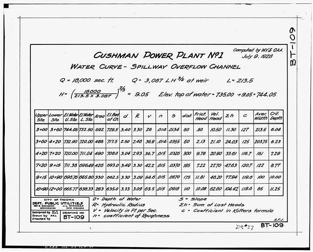 27. Photocopy of engineering drawing: CUSHMAN POWER PLANT NO. 1, WATER CURVE - SPILLWAY OVERFLOW CHANNEL. July 1928. Reference BT-109 (Original drawing located at City of Tacoma, Department of Public Utilities, Light Division, Tacoma, Washington) - Cushman No. 1 Hydroelectric Power Plant, Spillway, North Fork of Skokomish River, 5 miles West of Hood Canal, Hoodsport, Mason County, WA
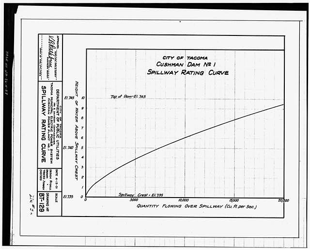 28. Photocopy of engineering drawing: SPILLWAY RATING CURVE. April 1931. Reference No. BT-129 (Original drawing located at City of Tacoma, Department of Public Utilities, Light Division, Tacoma, Washington) - Cushman No. 1 Hydroelectric Power Plant, Spillway, North Fork of Skokomish River, 5 miles West of Hood Canal, Hoodsport, Mason County, WA
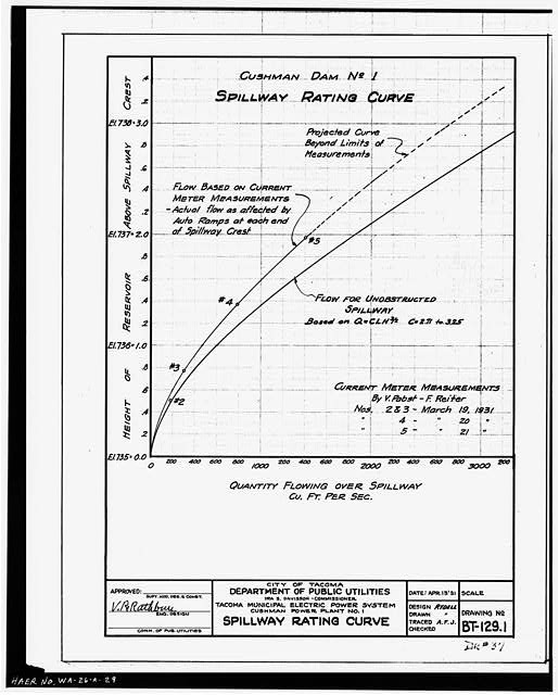 29. Photocopy of engineering drawing: SPILLWAY RATING CURVE. April 1931. Reference No. BT-129.1 (Original drawing located at City of Tacoma, Department of Public Utilities, Light Division, Tacoma, Washington) - Cushman No. 1 Hydroelectric Power Plant, Spillway, North Fork of Skokomish River, 5 miles West of Hood Canal, Hoodsport, Mason County, WA
Credits and rights are shown with each photograph. Is one of them yours, or wrongly credited? Open it and use Report a rights issue.